Mont Saint-Michel bay,satellite image
Bildnummer 11698883
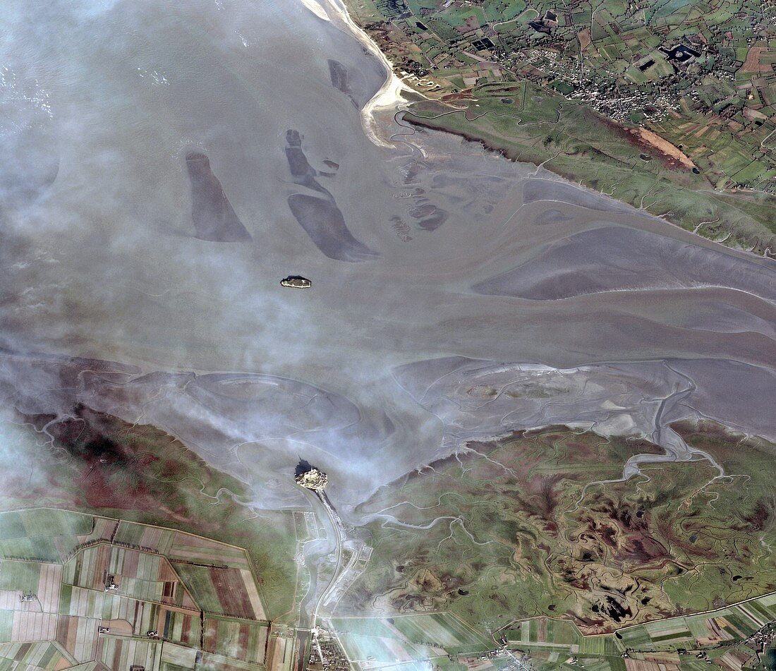
| Mont Saint-Michel bay,satellite image. North is at top. The island of Mont Saint-Michel is at lower centre,at the mouth of the Couesnon River on the Atlantic coast of Normandy,France. The rivers See and Selune flow from right. Buildings visible on the island include the central abbey and its spire,with shadows being cast north-westwards. Mont Saint-Michel,a UNESCO World Heritage Site,used to be a tidal island,but since the late 1800s has been accessible by a raised causeway from the mainland. It is surrounded by extensive mudflats at low tide. The island in the estuary near centre is Tombelaine. This image was acquired on 3 May 2012 by the CNES (French space agency) Pleiades satellite | |
| Lizenzart: | Lizenzpflichtig |
| Credit: | Science Photo Library / Spot Image / Astrium Services / CNES 2012 / EUROPEAN SPACE AGENCY |
| Bildgröße: | 9570 px × 8274 px |
| Modell-Rechte: | nicht erforderlich |
| Eigentums-Rechte: | nicht erforderlich |
| Restrictions: |
|
Preise für dieses Bild ab 15 €
Universitäten & Organisationen
(Informationsmaterial Digital, Informationsmaterial Print, Lehrmaterial Digital etc.)
ab 15 €
Redaktionell
(Bücher, Bücher: Sach- und Fachliteratur, Digitale Medien (redaktionell) etc.)
ab 30 €
Werbung
(Anzeigen, Aussenwerbung, Digitale Medien, Fernsehwerbung, Karten, Werbemittel, Zeitschriften etc.)
ab 55 €
Handelsprodukte
(bedruckte Textilie, Kalender, Postkarte, Grußkarte, Verpackung etc.)
ab 75 €
Pauschalpreise
Rechtepakete für die unbeschränkte Bildnutzung in Print oder Online
ab 495 €