South-East Asia deforestation,2000-2012
Bildnummer 11697353
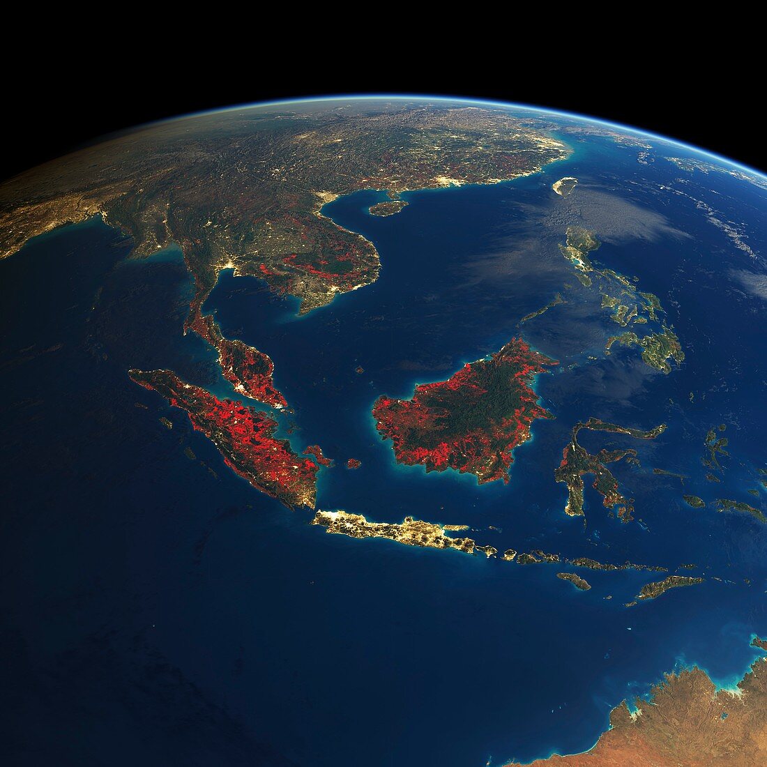
| South-East Asia deforestation,2000-2012. Spherical projection of South-East Asia (Earth's limb at top),showing the extent of deforestation (red areas) and urbanisation (yellow areas) in the period from 2000 to 2012. At centre are the main islands (Borneo,Java and Sumatra) of the Malay Archipelago,with mainland South-East Asia at upper left and eastern China at top. Deforestation is mainly seen in Sumatra (left) and Borneo (centre). Urbanisation dominates Java (lower centre),one of the world's most densely populated places. Deforestation data from the Global Forest Change dataset from Landsat 7's Enhanced Thematic Mapper Plus (ETM+) | |
| Lizenzart: | Lizenzpflichtig |
| Credit: | Science Photo Library / NASA / USGS / GOOGLE / UMD / HANSEN / FELIX PHARAND-DESCHENES, GLOBAIA |
| Bildgröße: | 4606 px × 4606 px |
| Modell-Rechte: | nicht erforderlich |
| Eigentums-Rechte: | nicht erforderlich |
| Restrictions: | - |
Preise für dieses Bild ab 15 €
Universitäten & Organisationen
(Informationsmaterial Digital, Informationsmaterial Print, Lehrmaterial Digital etc.)
ab 15 €
Redaktionell
(Bücher, Bücher: Sach- und Fachliteratur, Digitale Medien (redaktionell) etc.)
ab 30 €
Werbung
(Anzeigen, Aussenwerbung, Digitale Medien, Fernsehwerbung, Karten, Werbemittel, Zeitschriften etc.)
ab 55 €
Handelsprodukte
(bedruckte Textilie, Kalender, Postkarte, Grußkarte, Verpackung etc.)
ab 75 €
Pauschalpreise
Rechtepakete für die unbeschränkte Bildnutzung in Print oder Online
ab 495 €
Keywords
- 2000,
- 2012,
- 21. Jahrhundert,
- Abholzung,
- Asiatisch,
- Asien,
- Birma,
- Bodennutzung,
- China,
- Erde,
- Erdkunde,
- geografisch,
- Indochina,
- Indonesien,
- Indonesisch,
- Java,
- Kambodscha,
- Karte,
- Landsat 7,
- Laos,
- Malaiischer Archipel,
- Malaysia,
- Malaysisch,
- menschliche Geografie,
- Myanmar,
- Niemand,
- Ökologie,
- Ökologisch,
- Philippinen,
- Planet,
- Projektion,
- Regenwald,
- sphärische Projektion,
- Städte,
- Südostasien,
- Sulawesi,
- Sumatra,
- Thailand,
- Tropen,
- Tropisch,
- Umweltwissenschaften,
- Urbanisierung,
- Veränderung,
- Vietnam,
- Wald,
- Wälder,
- Zerstörung