South America deforestation,2000-2012
Bildnummer 11697352
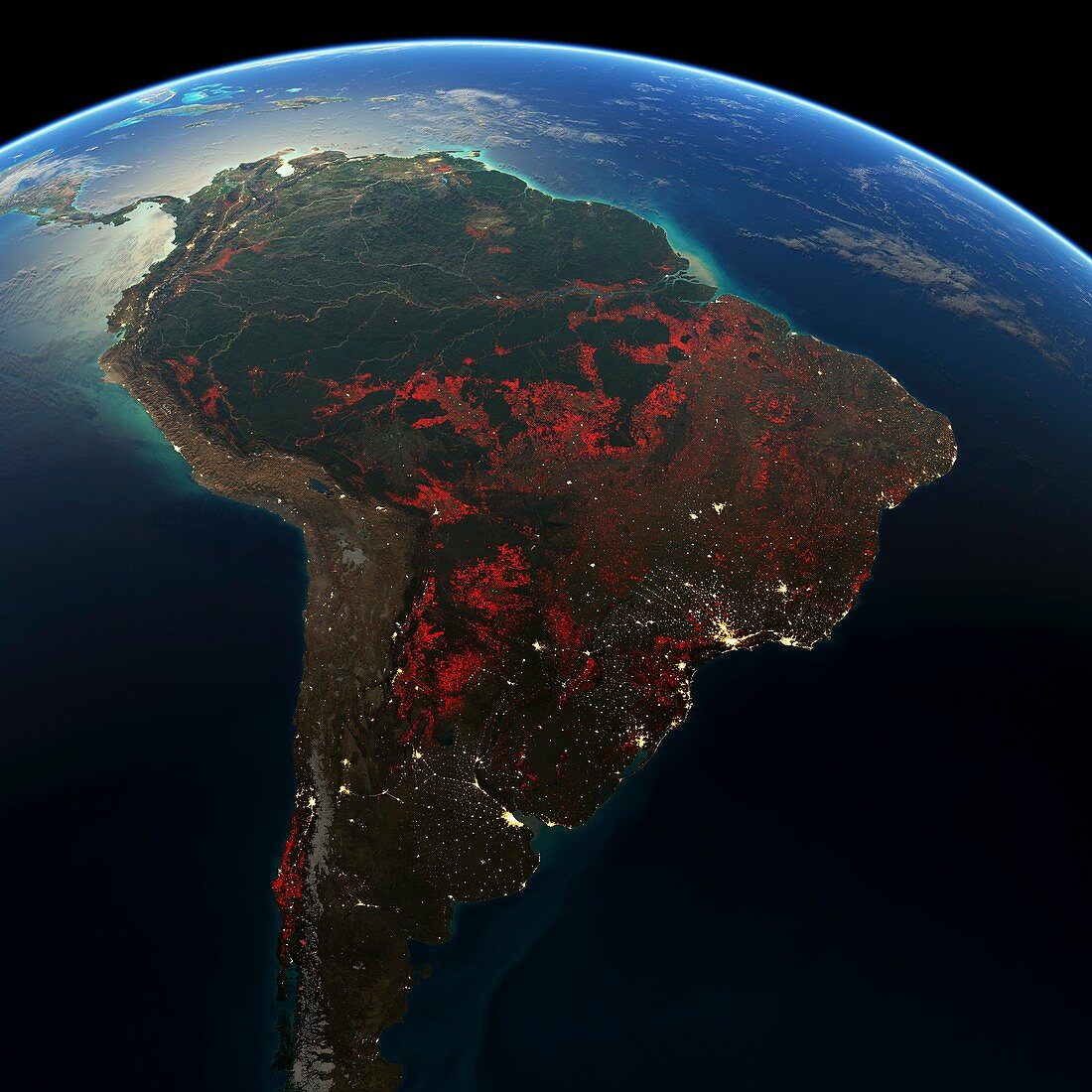
| South America deforestation,2000-2012. Close-up of a spherical projection of South America (Earth's limb at top),showing the extent of deforestation (red areas) and urbanisation (yellow areas) in the period from 2000 to 2012. The Amazon Basin is at top,with large areas of deforestation further south in areas of Brazil and Argentina. Urbanisation is most apparent in the big Atlantic coastal cities (centre right and lower centre). Deforestation data from the Global Forest Change dataset from Landsat 7's Enhanced Thematic Mapper Plus (ETM+) | |
| Lizenzart: | Lizenzpflichtig |
| Credit: | Science Photo Library / NASA / USGS / GOOGLE / UMD / HANSEN / FELIX PHARAND-DESCHENES, GLOBAIA |
| Bildgröße: | 4606 px × 4606 px |
| Modell-Rechte: | nicht erforderlich |
| Eigentums-Rechte: | nicht erforderlich |
| Restrictions: | - |
Preise für dieses Bild ab 15 €
Universitäten & Organisationen
(Informationsmaterial Digital, Informationsmaterial Print, Lehrmaterial Digital etc.)
ab 15 €
Redaktionell
(Bücher, Bücher: Sach- und Fachliteratur, Digitale Medien (redaktionell) etc.)
ab 30 €
Werbung
(Anzeigen, Aussenwerbung, Digitale Medien, Fernsehwerbung, Karten, Werbemittel, Zeitschriften etc.)
ab 55 €
Handelsprodukte
(bedruckte Textilie, Kalender, Postkarte, Grußkarte, Verpackung etc.)
ab 75 €
Pauschalpreise
Rechtepakete für die unbeschränkte Bildnutzung in Print oder Online
ab 495 €
Keywords
- 2000,
- 2012,
- 21. Jahrhundert,
- Abholzung,
- Amazonien,
- Argentinien,
- Argentinier,
- Bodennutzung,
- Brasilianer,
- Brasilien,
- Buenos Aires,
- Chile,
- Chilenisch,
- Erde,
- Erdkunde,
- geografisch,
- Karte,
- Krümmung,
- Kurve,
- Landsat 7,
- Lateinamerika,
- menschliche Geografie,
- Niemand,
- Ökologie,
- Ökologisch,
- Planet,
- Projektion,
- Regenwald,
- Rio De Janeiro,
- sphärische Projektion,
- Städte,
- Südamerika,
- Südamerikanisch,
- Tropen,
- Tropisch,
- Umweltwissenschaften,
- Urbanisierung,
- Veränderung,
- Wald,
- Wälder,
- Zerstörung