Florida,infrared Landsat 5 image
Bildnummer 11690138
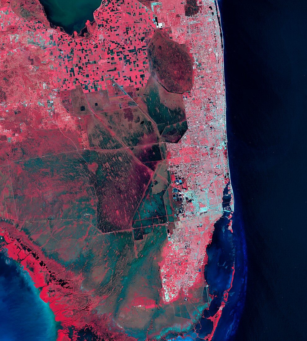
| Florida. Infrared satellite image of part of the peninsula of Florida,USA. North is towards left of top. At right is the Miami-Fort Lauderdale urban corridor (light blue). At centre are the wetlands of the Everglades. At upper centre are agricultural fields (bright red squares) and burnt fields (dark). Biscayne National Park is at bottom right. This image combines data from green,red,and near infrared channels recorded by the Landsat 5 satellite. Image obtained on 10 November 2011. The area shown here is around 160 kilometres across. For the same image with different spectral channels for different land cover features,see images C022/3736 and 3743 | |
| Lizenzart: | Lizenzpflichtig |
| Credit: | Science Photo Library / USGS Earth Explorer / Matt Radcliff / NASA |
| Bildgröße: | 4007 px × 4453 px |
| Modell-Rechte: | nicht erforderlich |
| Eigentums-Rechte: | nicht erforderlich |
| Restrictions: | - |
Preise für dieses Bild ab 15 €
Universitäten & Organisationen
(Informationsmaterial Digital, Informationsmaterial Print, Lehrmaterial Digital etc.)
ab 15 €
Redaktionell
(Bücher, Bücher: Sach- und Fachliteratur, Digitale Medien (redaktionell) etc.)
ab 30 €
Werbung
(Anzeigen, Aussenwerbung, Digitale Medien, Fernsehwerbung, Karten, Werbemittel, Zeitschriften etc.)
ab 55 €
Handelsprodukte
(bedruckte Textilie, Kalender, Postkarte, Grußkarte, Verpackung etc.)
ab 75 €
Pauschalpreise
Rechtepakete für die unbeschränkte Bildnutzung in Print oder Online
ab 495 €
Keywords
- 2011,
- 21. Jahrhundert,
- Ackerland,
- Amerikanisch,
- Biologie,
- biologisch,
- Bodennutzung,
- Erdbeobachtung,
- Everglades,
- Felder,
- Feuchtgebiet,
- Feuchtgebiete,
- Florida,
- Fort Lauderdale,
- geografisch,
- Geographie,
- infrarot,
- Kanäle,
- Küste,
- Küsten-,
- Küstenlinie,
- Landwirtschaft,
- landwirtschaftlich,
- Miami,
- Nah-Infrarot,
- Niemand,
- Nordamerika,
- nordamerikanisch,
- Ökologie,
- Ökologisch,
- optisch,
- Reihenfolge,
- Satellit,
- Satellitenbild,
- Serie,
- Sichtbar,
- Stadt,
- uns,
- USA,
- Vegetation,
- Vereinigte Staaten,
- Weltall