Salt lakes,Turkey,satellite image
Bildnummer 11688688
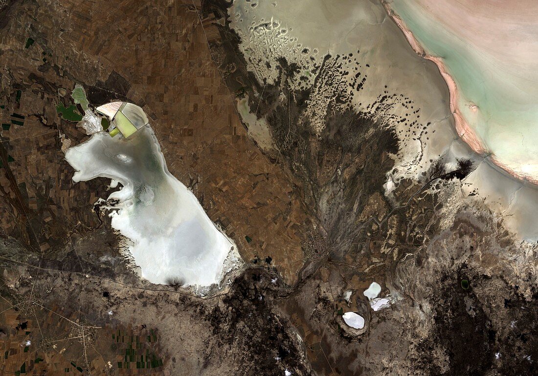
| Satellite image of Lake Tersakan (left) and part of Lake Tuz (top right) in Anatolia's central plateau,Turkey. Bright white areas are salt deposits where the saline water has evaporated over the summer. These deposits are used to calibrate the sensors of earth-observing satellite for the colour white. Image obtained by the Advanced Visible and Near Infrared Radiometer type-2 instrument on Japan's ALOS satellite on 21st October 2010 | |
| Lizenzart: | Lizenzpflichtig |
| Credit: | Science Photo Library / ESA / JAXA |
| Bildgröße: | 3160 px × 2208 px |
| Modell-Rechte: | nicht erforderlich |
| Eigentums-Rechte: | nicht erforderlich |
| Restrictions: |
|
Preise für dieses Bild ab 15 €
Universitäten & Organisationen
(Informationsmaterial Digital, Informationsmaterial Print, Lehrmaterial Digital etc.)
ab 15 €
Redaktionell
(Bücher, Bücher: Sach- und Fachliteratur, Digitale Medien (redaktionell) etc.)
ab 30 €
Werbung
(Anzeigen, Aussenwerbung, Digitale Medien, Fernsehwerbung, Karten, Werbemittel, Zeitschriften etc.)
ab 55 €
Handelsprodukte
(bedruckte Textilie, Kalender, Postkarte, Grußkarte, Verpackung etc.)
ab 75 €
Pauschalpreise
Rechtepakete für die unbeschränkte Bildnutzung in Print oder Online
ab 495 €