Giza Plateau and Cairo,ISS image
Bildnummer 11688103
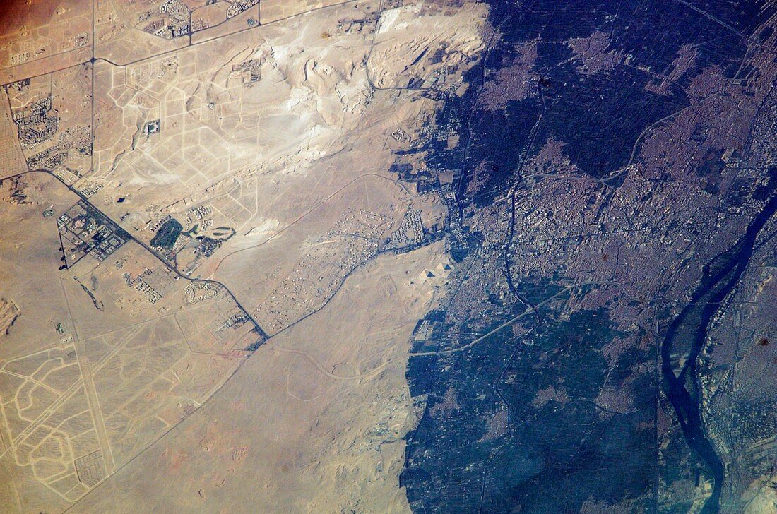
| Giza Plateau and Cairo,Egypt,as seen from the International Space Station (ISS). North is towards upper right. The pyramids at Giza are at centre on the Giza Plateau,on the outskirts of Cairo (right). The River Nile is at far right. These monuments were built between 2600 and 2500 BC,as tombs for the pharaohs of Ancient Egypt. Up to 230 metres across and 140 metres in height,they were the tallest structures in the world when built. Giza is a rapidly growing region of Cairo. New roads for large new developments are seen as lines in the desert hills at upper left and lower right. Photographed by an Expedition 7 crew member on 18 August 2003 | |
| Lizenzart: | Lizenzpflichtig |
| Credit: | Science Photo Library / NASA |
| Bildgröße: | 3028 px × 2004 px |
| Modell-Rechte: | nicht erforderlich |
| Eigentums-Rechte: | nicht erforderlich |
| Restrictions: | - |
Preise für dieses Bild ab 15 €
Universitäten & Organisationen
(Informationsmaterial Digital, Informationsmaterial Print, Lehrmaterial Digital etc.)
ab 15 €
Redaktionell
(Bücher, Bücher: Sach- und Fachliteratur, Digitale Medien (redaktionell) etc.)
ab 30 €
Werbung
(Anzeigen, Aussenwerbung, Digitale Medien, Fernsehwerbung, Karten, Werbemittel, Zeitschriften etc.)
ab 55 €
Handelsprodukte
(bedruckte Textilie, Kalender, Postkarte, Grußkarte, Verpackung etc.)
ab 75 €
Pauschalpreise
Rechtepakete für die unbeschränkte Bildnutzung in Print oder Online
ab 495 €
Keywords
- 21. Jahrhundert,
- Afrika,
- Afrikanisch,
- Ägypten,
- Ägyptisch,
- Antike,
- Archäologie,
- archäologisch,
- Astronautenfotografie,
- Delta,
- Erdbeobachtung,
- Expedition 7,
- geografisch,
- Geographie,
- Geschichte,
- Gizeh,
- historisch,
- Internationale Raumstation,
- iss Bild,
- Kairo,
- klassisch,
- Nekropole von Gizeh,
- Niemand,
- Nil,
- Pyramide,
- Pyramiden,
- Raum,
- Region,
- Satellitenbild,
- Stadt,
- Standort,
- Weltall,
- Wüste