Tothill Fields,Westminster
Bildnummer 11674224
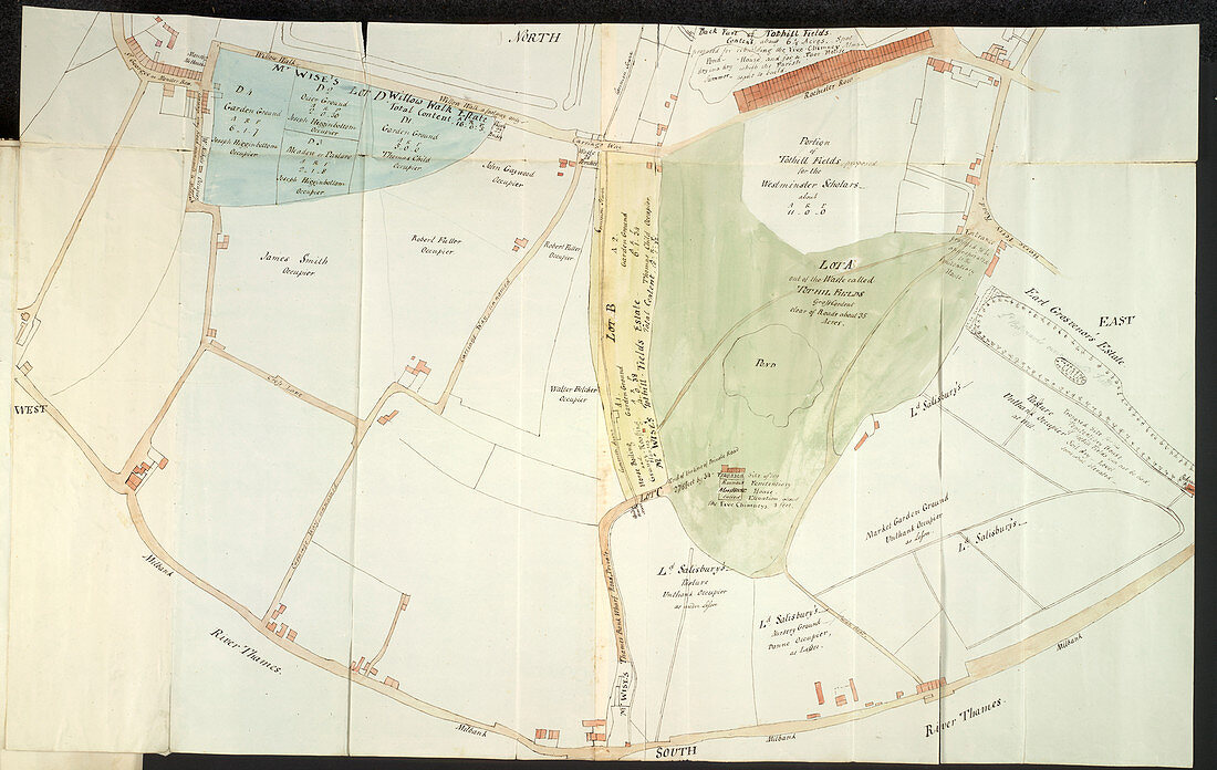
| Tothill Fields,Westminster,Whole plan Plan of Tothill Fields,Westminster; between Millbank and Westminster Abbey. The plan shows Rochester Row,Horseferry Road,and the site of the almshouses 'the Five Chimneys',built as pest-houses for victims of the plague Image taken from Pelham Papers. Originally published in England; circa 1796-1803 | |
| Lizenzart: | Lizenzpflichtig |
| Credit: | Science Photo Library / British Library |
| Bildgröße: | 5255 px × 3326 px |
| Modell-Rechte: | nicht erforderlich |
| Eigentums-Rechte: | nicht erforderlich |
| Restrictions: | - |
Preise für dieses Bild ab 15 €
Universitäten & Organisationen
(Informationsmaterial Digital, Informationsmaterial Print, Lehrmaterial Digital etc.)
ab 15 €
Redaktionell
(Bücher, Bücher: Sach- und Fachliteratur, Digitale Medien (redaktionell) etc.)
ab 30 €
Werbung
(Anzeigen, Aussenwerbung, Digitale Medien, Fernsehwerbung, Karten, Werbemittel, Zeitschriften etc.)
ab 55 €
Handelsprodukte
(bedruckte Textilie, Kalender, Postkarte, Grußkarte, Verpackung etc.)
ab 75 €
Pauschalpreise
Rechtepakete für die unbeschränkte Bildnutzung in Print oder Online
ab 495 €