Views and plans of Royal Bay
Bildnummer 11673834
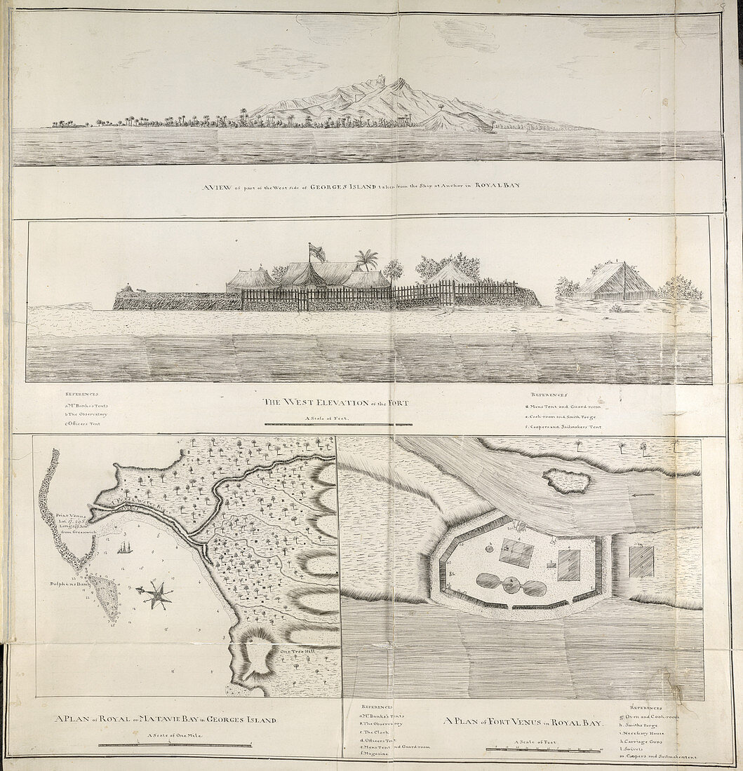
| Views and plans of Royal Bay,Whole folio Four views of Royal Bay,Otaheite Tahiti. A view of part of the west coast of George's Island,taken from the ship at anchor in Royal Bay. A view of the west elevation of Fort Venus. A plan of Royal or Matavie Bay. A plan of Fort Venus Image taken from Charts,Plans,and Drawings taken on board the Endeavour during Captain Cook's First Voyage,1768-1771. Originally published in Tahiti; 1771. Illustrated by Charles Praval | |
| Lizenzart: | Lizenzpflichtig |
| Credit: | Science Photo Library / British Library |
| Bildgröße: | 4102 px × 4260 px |
| Modell-Rechte: | nicht erforderlich |
| Eigentums-Rechte: | nicht erforderlich |
| Restrictions: | - |
Preise für dieses Bild ab 15 €
Universitäten & Organisationen
(Informationsmaterial Digital, Informationsmaterial Print, Lehrmaterial Digital etc.)
ab 15 €
Redaktionell
(Bücher, Bücher: Sach- und Fachliteratur, Digitale Medien (redaktionell) etc.)
ab 30 €
Werbung
(Anzeigen, Aussenwerbung, Digitale Medien, Fernsehwerbung, Karten, Werbemittel, Zeitschriften etc.)
ab 55 €
Handelsprodukte
(bedruckte Textilie, Kalender, Postkarte, Grußkarte, Verpackung etc.)
ab 75 €
Pauschalpreise
Rechtepakete für die unbeschränkte Bildnutzung in Print oder Online
ab 495 €
Keywords
- Asien,
- Bucht,
- charles Praval,
- Englisch,
- Festung,
- James cook,
- Karte,
- Kartographie,
- Koch,
- Kochen,
- komplex,
- königlich,
- Küste,
- Küstenlinie,
- Pläne,
- Reise,
- Reisen,
- Strand,
- Topographie