Europe,topographic and bathymetric map
Bildnummer 11672802
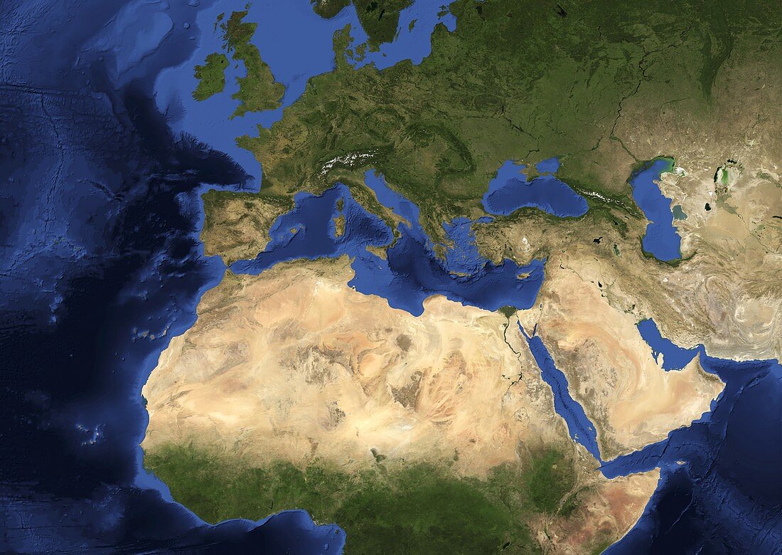
| Europe and Africa. Blue Marble: Next Generation cloud-free topographic and bathymetric map of Europe and Africa in July 2004. Highlands and lowlands of the continents are shown as ridges and flat areas. The seabed depth varies from shallow (light blue) on the continental shelves,to deep ocean basins (dark blue). Topographic and bathymetric data is usually gathered by using aerial and satellite imagery combined with radar and sonar mapping. Landcover data is from NASA's Moderate Resolution Imaging Spectroradiometer (MODIS) sensor aboard the Terra satellite | |
| Lizenzart: | Lizenzpflichtig |
| Credit: | Science Photo Library / NASA |
| Bildgröße: | 4978 px × 3529 px |
| Modell-Rechte: | nicht erforderlich |
| Eigentums-Rechte: | nicht erforderlich |
| Restrictions: | - |
Preise für dieses Bild ab 15 €
Universitäten & Organisationen
(Informationsmaterial Digital, Informationsmaterial Print, Lehrmaterial Digital etc.)
ab 15 €
Redaktionell
(Bücher, Bücher: Sach- und Fachliteratur, Digitale Medien (redaktionell) etc.)
ab 30 €
Werbung
(Anzeigen, Aussenwerbung, Digitale Medien, Fernsehwerbung, Karten, Werbemittel, Zeitschriften etc.)
ab 55 €
Handelsprodukte
(bedruckte Textilie, Kalender, Postkarte, Grußkarte, Verpackung etc.)
ab 75 €
Pauschalpreise
Rechtepakete für die unbeschränkte Bildnutzung in Print oder Online
ab 495 €
Keywords
- 21. Jahrhundert,
- abgebildet,
- Afrika,
- Afrikanisch,
- Altimetrie,
- altimetrisch,
- Bathymetrie,
- bathymetrisch,
- Berge,
- Erdbeobachtung,
- Erde,
- Europa,
- europäisch,
- geografisch,
- Geographie,
- Grat,
- Höhe,
- Karte,
- Kontinent,
- Kontinente,
- Land,
- Marine,
- Meer,
- Meeresboden,
- Meereskunde,
- Mittlerer Osten,
- modis,
- nächste Generation,
- Nahost,
- NASA,
- Ozean,
- ozeanisch,
- Planet,
- Regale,
- Satellit,
- Satellitenbild,
- Terra,
- topografisch,
- Topographie,
- Weltall,
- Zusammengesetzt