Super typhoon Haiyan,November 2013
Bildnummer 11658992
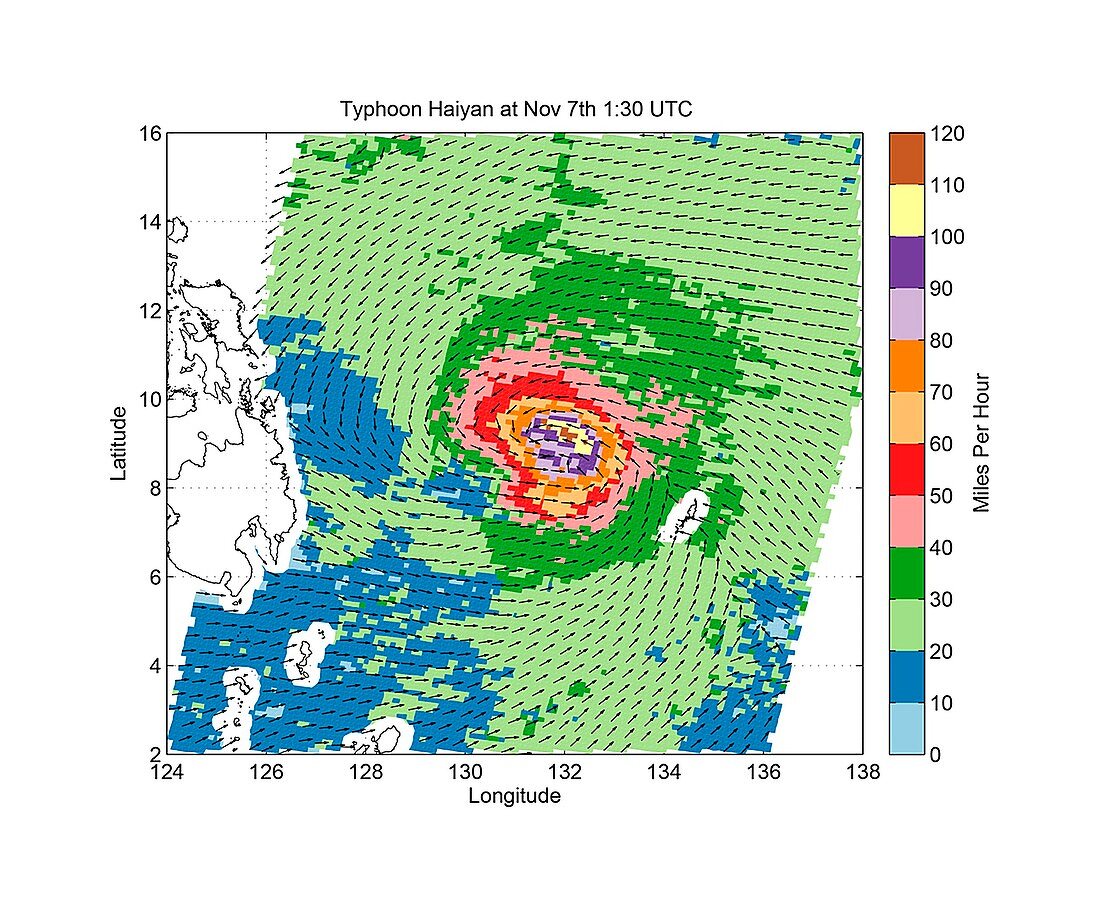
| Super typhoon Haiyan. Radar satellite image of super typhoon Haiyan over the Philippines on 7th November 2013 showing wind speed and direction. The Category 5 storm,with wind speeds up to 314 kilometres per hour,may be the strongest tropical cyclone ever to make landfall. It devastated large areas of the Philippines,particularly Samar Island and Leyte,affecting 9 million people. Over 3,500 people were killed and more than 12,000 injured. Data from the OSCAT radar scatterometer on the Indian Space Research Organization’s OceanSAT-2 satellite | |
| Lizenzart: | Lizenzpflichtig |
| Credit: | Science Photo Library / JPL-Caltech / NASA / ISRO |
| Bildgröße: | 2093 px × 1713 px |
| Modell-Rechte: | nicht erforderlich |
| Eigentums-Rechte: | nicht erforderlich |
| Restrictions: | - |
Preise für dieses Bild ab 15 €
Universitäten & Organisationen
(Informationsmaterial Digital, Informationsmaterial Print, Lehrmaterial Digital etc.)
ab 15 €
Redaktionell
(Bücher, Bücher: Sach- und Fachliteratur, Digitale Medien (redaktionell) etc.)
ab 30 €
Werbung
(Anzeigen, Aussenwerbung, Digitale Medien, Fernsehwerbung, Karten, Werbemittel, Zeitschriften etc.)
ab 55 €
Handelsprodukte
(bedruckte Textilie, Kalender, Postkarte, Grußkarte, Verpackung etc.)
ab 75 €
Pauschalpreise
Rechtepakete für die unbeschränkte Bildnutzung in Print oder Online
ab 495 €