Earth topography,artwork
Bildnummer 11656206
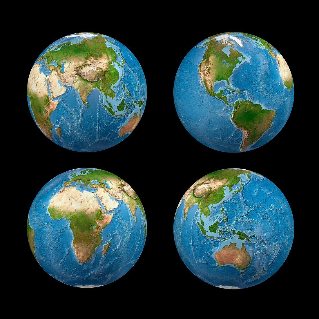
| Earth topography. Computer artwork based on satellite data,showing the topography of the Earth (altimetry and bathymetry). On land,yellow indicates the lower altitude regions,while brown the highest. In the oceans,dark blue corresponds to the deeper regions (abyssal zones) | |
| Lizenzart: | Lizenzpflichtig |
| Credit: | Science Photo Library / Clarivan, Carlos |
| Bildgröße: | 4182 px × 4182 px |
| Modell-Rechte: | nicht erforderlich |
| Eigentums-Rechte: | nicht erforderlich |
| Restrictions: | - |
Preise für dieses Bild ab 15 €
Universitäten & Organisationen
(Informationsmaterial Digital, Informationsmaterial Print, Lehrmaterial Digital etc.)
ab 15 €
Redaktionell
(Bücher, Bücher: Sach- und Fachliteratur, Digitale Medien (redaktionell) etc.)
ab 30 €
Werbung
(Anzeigen, Aussenwerbung, Digitale Medien, Fernsehwerbung, Karten, Werbemittel, Zeitschriften etc.)
ab 55 €
Handelsprodukte
(bedruckte Textilie, Kalender, Postkarte, Grußkarte, Verpackung etc.)
ab 75 €
Pauschalpreise
Rechtepakete für die unbeschränkte Bildnutzung in Print oder Online
ab 495 €
Keywords
- Altimetrie,
- altimetrisch,
- Astronomie,
- astronomisch,
- ausgeschnitten,
- Ausschnitte,
- Bathymetrie,
- bathymetrisch,
- Ebenen,
- Erde,
- geografisch,
- Geographie,
- Höhe,
- Illustration,
- Kontinent,
- Kontinente,
- Kunstwerk,
- Land,
- Meer,
- Ozean,
- Planet,
- Planetenwissenschaft,
- schwarzer Hintergrund,
- Sonnensystem,
- Tiefe,
- topografisch,
- Topographie,
- topographisch,
- Weltall,
- weltweit