Brighton,historical aerial photograph
Bildnummer 11654739
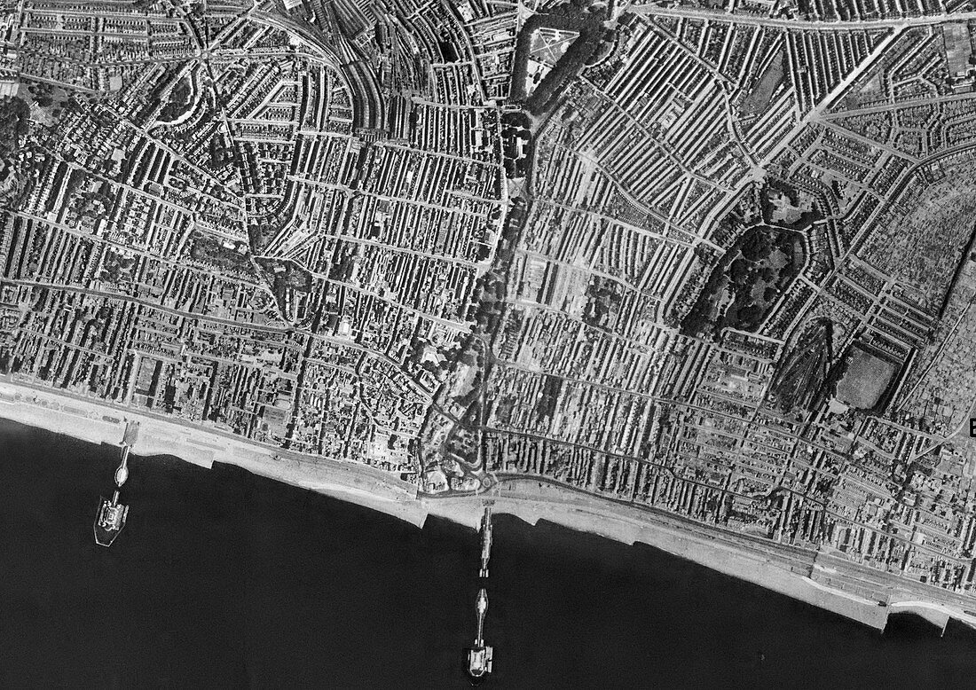
| Brighton,historical aerial photograph mosaic taken between 1939 and 1952. Between 1939 - 1942 Hitler's Luftwaffe secretly photographed large areas of Great Britain and Ireland for target reconnaissance. From 1946 until 1952 the Royal Air Force began detailed aerial surveys for planning and reconstruction work following the Second World War. Both sources have been used to create these historical aerial maps. Present day images of the same towns and cities reveal extensive changes to roads,buildings and public spaces. See image C016/9926 for the same aerial photograph taken in 2012 | |
| Lizenzart: | Lizenzpflichtig |
| Credit: | Science Photo Library / Getmapping Plc |
| Bildgröße: | 4989 px × 3528 px |
| Modell-Rechte: | nicht erforderlich |
| Eigentums-Rechte: | nicht erforderlich |
| Restrictions: | - |
Preise für dieses Bild ab 15 €
Universitäten & Organisationen
(Informationsmaterial Digital, Informationsmaterial Print, Lehrmaterial Digital etc.)
ab 15 €
Redaktionell
(Bücher, Bücher: Sach- und Fachliteratur, Digitale Medien (redaktionell) etc.)
ab 30 €
Werbung
(Anzeigen, Aussenwerbung, Digitale Medien, Fernsehwerbung, Karten, Werbemittel, Zeitschriften etc.)
ab 55 €
Handelsprodukte
(bedruckte Textilie, Kalender, Postkarte, Grußkarte, Verpackung etc.)
ab 75 €
Pauschalpreise
Rechtepakete für die unbeschränkte Bildnutzung in Print oder Online
ab 495 €