Global surface currents 2005-2007
Bildnummer 11653002
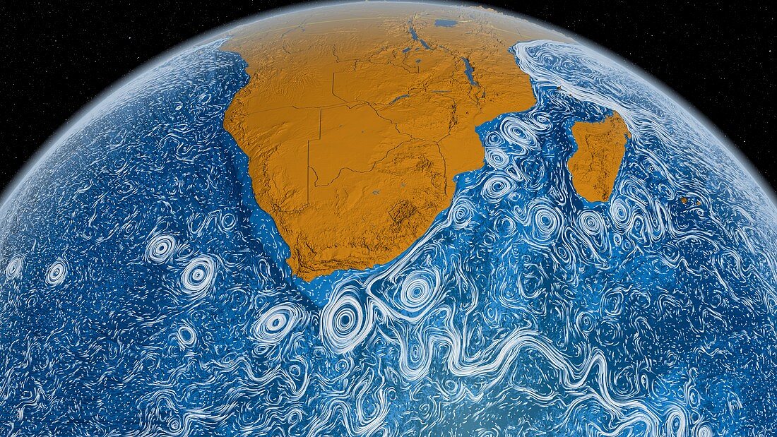
| Global surface currents 2005-2007. Computer visualisation showing ocean surface currents around the tip of southern Africa,during the period from June 2005 to December 2007. This visualisation was produced using model output from the joint MIT/JPL project: 'Estimating the Circulation and Climate of the Ocean,Phase II' (ECCO2). ECCO2 uses the MIT (Massachusetts Institute of Technology) general circulation model (MITgcm) to synthesise satellite and in-situ data of the global ocean and sea-ice at resolutions that begin to resolve ocean eddies and other narrow current systems,which transport heat and carbon in the oceans | |
| Lizenzart: | Lizenzpflichtig |
| Credit: | Science Photo Library / NASA |
| Bildgröße: | 6133 px × 3450 px |
| Modell-Rechte: | nicht erforderlich |
| Eigentums-Rechte: | nicht erforderlich |
| Restrictions: | - |
Preise für dieses Bild ab 15 €
Universitäten & Organisationen
(Informationsmaterial Digital, Informationsmaterial Print, Lehrmaterial Digital etc.)
ab 15 €
Redaktionell
(Bücher, Bücher: Sach- und Fachliteratur, Digitale Medien (redaktionell) etc.)
ab 30 €
Werbung
(Anzeigen, Aussenwerbung, Digitale Medien, Fernsehwerbung, Karten, Werbemittel, Zeitschriften etc.)
ab 55 €
Handelsprodukte
(bedruckte Textilie, Kalender, Postkarte, Grußkarte, Verpackung etc.)
ab 75 €
Pauschalpreise
Rechtepakete für die unbeschränkte Bildnutzung in Print oder Online
ab 495 €
Keywords
- 21. Jahrhundert,
- abgebildet,
- Afrikanisch,
- aktuell,
- aktuelles System,
- Atlantisch,
- Bewegung,
- Bewegungen,
- Erdbeobachtung,
- Erde,
- Erdkunde,
- geografisch,
- Geographie,
- Hydrologie,
- Illustration,
- Indischer Ozean,
- Karte,
- Kontinent,
- Kontinente,
- Kunstwerk,
- Küste,
- Küsten-,
- Madagaskar,
- Meer,
- mit JPL,
- mitgcm,
- Ozean,
- Ozeane,
- Phase 2,
- Südafrika,
- Transport,
- Umwelt,
- Umweltwissenschaften,
- Wasser,
- Welt,
- Weltall,
- weltweit,
- Zwei