Indian Ocean,satellite imaging data
Bildnummer 11648932
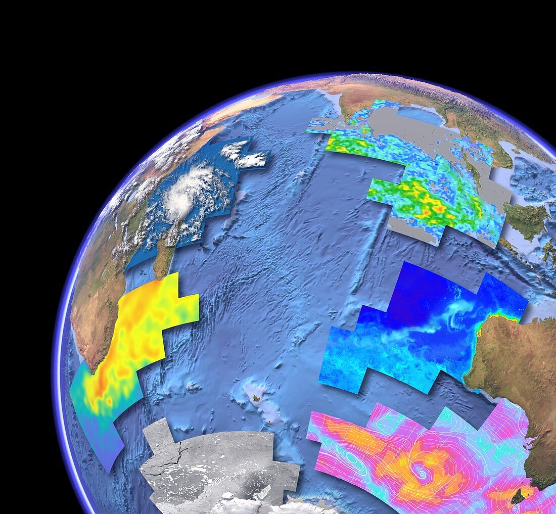
| Indian Ocean,satellite imaging data. Computer graphic of the Indian Ocean on an Earth globe,showing the various parameters that can be measured by satellite instruments. Sea floor topography (bathymetry) is from the ERS-1 and Geosat satellites. Other parameters are (clockwise from lower left): sea surface temperature from an infrared radiometer (ATSR on the ERS-1 satellite); cloud cover (MODIS on Terra); rainfall from a microwave imager (Tropical Rainfall Monitoring Mission); chlorophyll concentration (MODIS on Aqua); wind speed from a microwave scatterometer (QuickScat); sea ice cover from an imaging radar (SAR on Radarsat) | |
| Lizenzart: | Lizenzpflichtig |
| Credit: | Science Photo Library / Planetary Visions |
| Bildgröße: | 4390 px × 4060 px |
| Modell-Rechte: | nicht erforderlich |
| Eigentums-Rechte: | nicht erforderlich |
| Restrictions: | - |
Preise für dieses Bild ab 15 €
Universitäten & Organisationen
(Informationsmaterial Digital, Informationsmaterial Print, Lehrmaterial Digital etc.)
ab 15 €
Redaktionell
(Bücher, Bücher: Sach- und Fachliteratur, Digitale Medien (redaktionell) etc.)
ab 30 €
Werbung
(Anzeigen, Aussenwerbung, Digitale Medien, Fernsehwerbung, Karten, Werbemittel, Zeitschriften etc.)
ab 55 €
Handelsprodukte
(bedruckte Textilie, Kalender, Postkarte, Grußkarte, Verpackung etc.)
ab 75 €
Pauschalpreise
Rechtepakete für die unbeschränkte Bildnutzung in Print oder Online
ab 495 €
Keywords
- Afrika,
- Afrikanisch,
- Antarktis,
- aqua,
- Asiatisch,
- Asien,
- Australien,
- australisch,
- Bathymetrie,
- bathymetrisch,
- Biologie,
- biologisch,
- Botanik,
- botanisch,
- Erdbeobachtung,
- Erde,
- Erdkunde,
- ERS-1,
- Fauna,
- Flora,
- gemischt,
- Globus,
- Indien,
- Indischer Ozean,
- Indonesien,
- Insel,
- Inseln,
- Küsten,
- Küsten-,
- Land,
- Madagaskar,
- Malaiischer Archipel,
- Malaysia,
- Marine,
- Mauritius,
- Meer,
- Meeresbiologie,
- Meeresboden,
- Meereskunde,
- Meteorologie,
- meteorologisch,
- modis,
- Natur,
- Ozean,
- Parameter,
- Planet,
- Reichweite,
- Satellit,
- Satellitenbild,
- Sri Lanka,
- Terra,
- Tiefe,
- topografisch,
- Topographie,
- TRMM,
- Vergleich,
- vergleichen,
- Weltall,
- Wetter,
- Wolkendecke,
- Zoologie,
- zoologisch