Indian Ocean,with clouds
Bildnummer 11648928
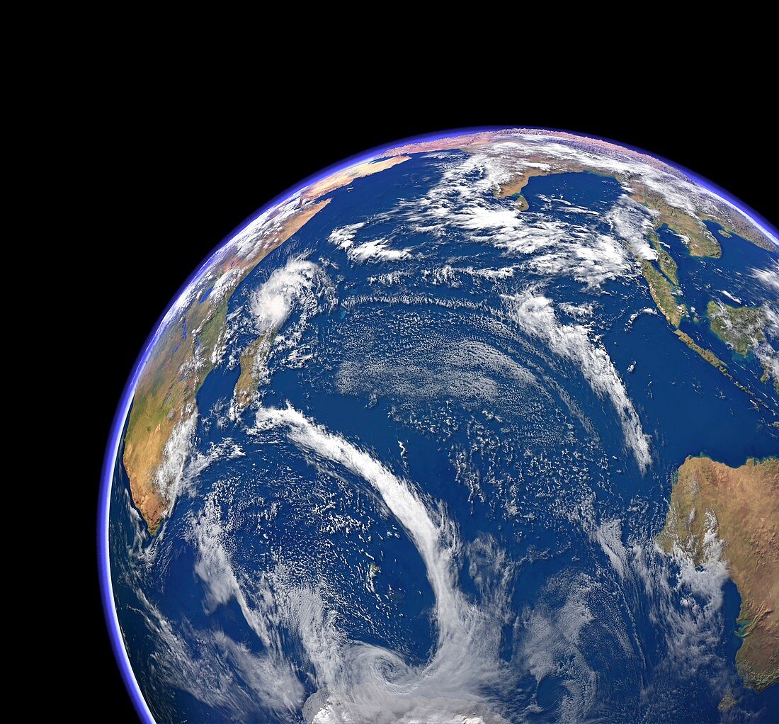
| Indian Ocean,with clouds. Computer graphic of the Indian Ocean on an Earth globe,generated using satellite and mapping data. Clouds,land and sea in natural colours were combined with exaggerated topographic data. The Indian Ocean is surrounded by Africa (upper left),Asia (across top),Australia (lower right),and Antarctica (bottom centre). A tropical storm (upper left) lies to the north of Madagascar,while a large low pressure system is circulating just off the Antarctic coast,with a long bank of cloud north of Kerguelen. Cloud data from the Moderate Resolution Imaging Spectroradiometer (MODIS) on NASA's Terra satellite | |
| Lizenzart: | Lizenzpflichtig |
| Credit: | Science Photo Library / Planetary Visions |
| Bildgröße: | 4554 px × 4230 px |
| Modell-Rechte: | nicht erforderlich |
| Eigentums-Rechte: | nicht erforderlich |
| Restrictions: | - |
Preise für dieses Bild ab 15 €
Universitäten & Organisationen
(Informationsmaterial Digital, Informationsmaterial Print, Lehrmaterial Digital etc.)
ab 15 €
Redaktionell
(Bücher, Bücher: Sach- und Fachliteratur, Digitale Medien (redaktionell) etc.)
ab 30 €
Werbung
(Anzeigen, Aussenwerbung, Digitale Medien, Fernsehwerbung, Karten, Werbemittel, Zeitschriften etc.)
ab 55 €
Handelsprodukte
(bedruckte Textilie, Kalender, Postkarte, Grußkarte, Verpackung etc.)
ab 75 €
Pauschalpreise
Rechtepakete für die unbeschränkte Bildnutzung in Print oder Online
ab 495 €
Keywords
- Afrika,
- Afrikanisch,
- Antarktis,
- Asiatisch,
- Asien,
- Australien,
- australisch,
- Erdbeobachtung,
- Erde,
- Erdkunde,
- Globus,
- Indien,
- Indischer Ozean,
- Indonesien,
- Insel,
- Inseln,
- Küsten,
- Küsten-,
- Land,
- Madagaskar,
- Malaiischer Archipel,
- Malaysia,
- Marine,
- Mauritius,
- Meer,
- Meereskunde,
- Meteorologie,
- meteorologisch,
- modis,
- Ozean,
- Planet,
- Satellit,
- Satellitenbild,
- Sri Lanka,
- Terra,
- Tropensturm,
- Weltall,
- Wetter,
- Wolken,
- Wolkenbank,
- Wolkendecke,
- Wolkig