Europe,satellite image
Bildnummer 11641173
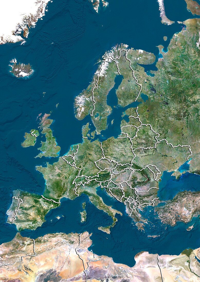
| Europe. North is at top. Satellite image of Europe,showing the borders (white lines) of the countries. Image compiled from data acquired by LANDSAT satellites,in 2012 | |
| Lizenzart: | Lizenzpflichtig |
| Credit: | Science Photo Library / Planetobserver |
| Bildgröße: | 3519 px × 4972 px |
| Modell-Rechte: | nicht erforderlich |
| Restrictions: | - |
Preise für dieses Bild ab 15 €
Universitäten & Organisationen
(Informationsmaterial Digital, Informationsmaterial Print, Lehrmaterial Digital etc.)
ab 15 €
Redaktionell
(Bücher, Bücher: Sach- und Fachliteratur, Digitale Medien (redaktionell) etc.)
ab 30 €
Werbung
(Anzeigen, Aussenwerbung, Digitale Medien, Fernsehwerbung, Karten, Werbemittel, Zeitschriften etc.)
ab 55 €
Handelsprodukte
(bedruckte Textilie, Kalender, Postkarte, Grußkarte, Verpackung etc.)
ab 75 €
Pauschalpreise
Rechtepakete für die unbeschränkte Bildnutzung in Print oder Online
ab 495 €
Keywords
- 2012,
- 21. Jahrhundert,
- Ägäisches Meer,
- Atlantischer Ozean,
- Erdbeobachtung,
- Europa,
- geografisch,
- Geographie,
- Grenze,
- Grenzen,
- Großbritannien,
- Iberische Halbinsel,
- Irland,
- Island,
- Karte,
- Kartographie,
- Kontinent,
- Kontinente,
- Land,
- Länder,
- Mittelmeer,
- Nation,
- Nationen,
- Nordsee,
- Ozeane,
- Pazifik,
- Rand,
- Satellit,
- Satellitenbild,
- Skandinavien,
- topografisch,
- Topographie,
- Umwelt,
- Vereinigtes Königreich,
- Vogelperspektive,
- Von Oben,
- Weltall