Bavaria,Germany,relief map
Bildnummer 11639717
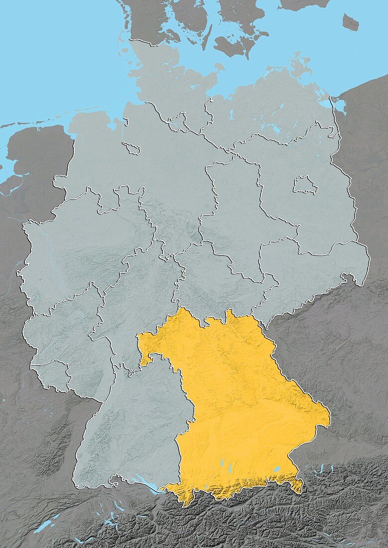
| Bavaria,Germany. North is at top. Relief map compiled from satellite data,showing the state of Bavaria (yellow),Germany,with the surrounding German states shaded out (grey). The North Sea (blue,upper left) and Baltic Sea (blue,upper right) can also be seen. Germany is located in Western and Central Europe and is bordered by Denmark (top centre),Poland (upper right),the Czech Republic (right),Austria (bottom right),Switzerland (bottom left),France (lower left),Luxembourg (small,centre left),Belgium (left),and the Netherlands (upper left). Image compiled from data acquired by the LANDSAT 5 and 7 satellites,in 2000. Images highlighting all other regions of this country are available. For further information please contact SPL | |
| Lizenzart: | Lizenzpflichtig |
| Credit: | Science Photo Library / Planetobserver |
| Bildgröße: | 3519 px × 4972 px |
| Modell-Rechte: | nicht erforderlich |
| Restrictions: | - |
Preise für dieses Bild ab 15 €
Universitäten & Organisationen
(Informationsmaterial Digital, Informationsmaterial Print, Lehrmaterial Digital etc.)
ab 15 €
Redaktionell
(Bücher, Bücher: Sach- und Fachliteratur, Digitale Medien (redaktionell) etc.)
ab 30 €
Werbung
(Anzeigen, Aussenwerbung, Digitale Medien, Fernsehwerbung, Karten, Werbemittel, Zeitschriften etc.)
ab 55 €
Handelsprodukte
(bedruckte Textilie, Kalender, Postkarte, Grußkarte, Verpackung etc.)
ab 75 €
Pauschalpreise
Rechtepakete für die unbeschränkte Bildnutzung in Print oder Online
ab 495 €
Keywords
- 2000,
- 21. Jahrhundert,
- Bayern,
- Belgien,
- Dänemark,
- Deutschland,
- Erdbeobachtung,
- Europa,
- europäisch,
- Frankreich,
- geografisch,
- Geographie,
- Grenze,
- Grenzen,
- Karte,
- Kartographie,
- Küste,
- Küsten-,
- Küstenlinie,
- Land,
- Länder,
- Landsat 7,
- Luxemburg,
- maskiert,
- Nation,
- Natur,
- Niederlande,
- Nordsee,
- Österreich,
- Ostsee,
- Polen,
- Rand,
- Satellit,
- Satellitenbild,
- Schweiz,
- Staat,
- topografisch,
- Topographie,
- Tschechien,
- Ufer,
- Umwelt,
- Vogelperspektive,
- Von Oben,
- Wasser,
- Weltall,
- Westeuropa,
- wolkenlos