Virginia,USA,satellite image
Bildnummer 11639702
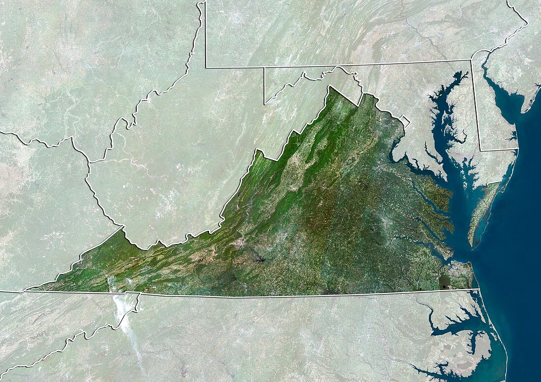
| Virginia,USA. North is at top. Natural colour satellite image of the USA,showing the state of Virginia,with the surrounding states shaded out. The Atlantic Ocean (blue) is also shown. The USA consists of 50 states. 48 are situated in southern North America,with the other two being Alaska and Hawaii. Virginia is located in the South Atlantic region of the United States. Image compiled from data acquired by the LANDSAT 5 and 7 satellites,in 2000. Images highlighting all other regions of this country are available. For further information please contact SPL | |
| Lizenzart: | Lizenzpflichtig |
| Credit: | Science Photo Library / Planetobserver |
| Bildgröße: | 4978 px × 3523 px |
| Modell-Rechte: | nicht erforderlich |
| Restrictions: | - |
Preise für dieses Bild ab 15 €
Universitäten & Organisationen
(Informationsmaterial Digital, Informationsmaterial Print, Lehrmaterial Digital etc.)
ab 15 €
Redaktionell
(Bücher, Bücher: Sach- und Fachliteratur, Digitale Medien (redaktionell) etc.)
ab 30 €
Werbung
(Anzeigen, Aussenwerbung, Digitale Medien, Fernsehwerbung, Karten, Werbemittel, Zeitschriften etc.)
ab 55 €
Handelsprodukte
(bedruckte Textilie, Kalender, Postkarte, Grußkarte, Verpackung etc.)
ab 75 €
Pauschalpreise
Rechtepakete für die unbeschränkte Bildnutzung in Print oder Online
ab 495 €
Keywords
- 2000,
- 21. Jahrhundert,
- Erdbeobachtung,
- geografisch,
- Geographie,
- Grenze,
- Grenzen,
- Karte,
- Kartographie,
- Küste,
- Küsten-,
- Küstenlinie,
- Land,
- Länder,
- Landsat 7,
- maskiert,
- Nation,
- Natur,
- Natürliche Farbe,
- Nordamerika,
- nordamerikanisch,
- Ozean,
- Rand,
- Satellit,
- Satellitenbild,
- Staat,
- Südatlantik,
- topografisch,
- Topographie,
- Ufer,
- Umwelt,
- uns,
- USA,
- Vereinigte Staaten,
- Virginia,
- Vogelperspektive,
- Von Oben,
- Wasser,
- Weltall