Mariana Trench,bathymetric map
Bildnummer 11636539
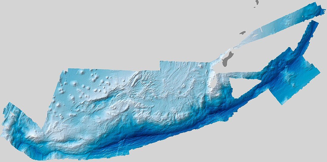
| Mariana Trench. Bathymetric map showing the varying depths of the Mariana Trench in the Pacific Ocean. Depths are reflected by shades of blue,with the deepest reaches represented by the darkest blues. The Mariana trench is the deepest point on Earth. This map was compiled from August to October 2010,using multi-beam echo sounders mounted on the hulls of ships. These instruments send pulsed sound waves towards the seafloor and then record the echo-like reflections. Multi-beam sounders send those pulses out in a fan-shape,allowing researchers to form three-dimensional images of the bottom | |
| Lizenzart: | Lizenzpflichtig |
| Credit: | Science Photo Library / NASA |
| Bildgröße: | 6003 px × 2976 px |
| Modell-Rechte: | nicht erforderlich |
| Restrictions: | - |
Preise für dieses Bild ab 15 €
Universitäten & Organisationen
(Informationsmaterial Digital, Informationsmaterial Print, Lehrmaterial Digital etc.)
ab 15 €
Redaktionell
(Bücher, Bücher: Sach- und Fachliteratur, Digitale Medien (redaktionell) etc.)
ab 30 €
Werbung
(Anzeigen, Aussenwerbung, Digitale Medien, Fernsehwerbung, Karten, Werbemittel, Zeitschriften etc.)
ab 55 €
Handelsprodukte
(bedruckte Textilie, Kalender, Postkarte, Grußkarte, Verpackung etc.)
ab 75 €
Pauschalpreise
Rechtepakete für die unbeschränkte Bildnutzung in Print oder Online
ab 495 €