East Pacific Rise,topographic map
Bildnummer 11635318
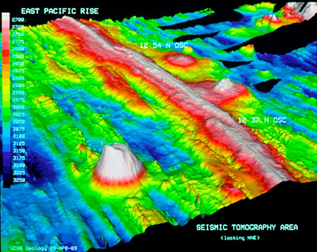
| East Pacific Rise. Topographic map of the seabed of the Pacific Ocean around part of the East Pacific Rise (red),a mid-ocean ridge that runs northwards from near Antarctica to the Gulf of California. It is a divergent plate boundary where new oceanic crust is forming as two tectonic plates move apart. This view looks north-north-east in an area between latitudes 12 and 13 degrees North. The plates here are the Pacific Plate to the west (lower left) and the Cocos Plate to the east (upper right). The colour-coded key (left) shows depths ranging from 2700 metres (light red) to 3250 metres (dark blue). Image data obtained in 1989 | |
| Lizenzart: | Lizenzpflichtig |
| Credit: | Science Photo Library / MacDonald, Dr. Ken |
| Bildgröße: | 3318 px × 2646 px |
| Modell-Rechte: | nicht erforderlich |
| Eigentums-Rechte: | nicht erforderlich |
| Restrictions: | - |
Preise für dieses Bild ab 15 €
Universitäten & Organisationen
(Informationsmaterial Digital, Informationsmaterial Print, Lehrmaterial Digital etc.)
ab 15 €
Redaktionell
(Bücher, Bücher: Sach- und Fachliteratur, Digitale Medien (redaktionell) etc.)
ab 30 €
Werbung
(Anzeigen, Aussenwerbung, Digitale Medien, Fernsehwerbung, Karten, Werbemittel, Zeitschriften etc.)
ab 55 €
Handelsprodukte
(bedruckte Textilie, Kalender, Postkarte, Grußkarte, Verpackung etc.)
ab 75 €
Pauschalpreise
Rechtepakete für die unbeschränkte Bildnutzung in Print oder Online
ab 495 €
Keywords
- 1900er Jahre,
- 1980er Jahre,
- 20. Jahrhundert,
- 3-d,
- 3-dimensional,
- 3D,
- Bathymetrie,
- bathymetrisch,
- Berg,
- Berge,
- Dreidimensional,
- Erdkunde,
- geografisch,
- Geologie,
- geologisch,
- Grat,
- Karte,
- Linderung,
- Meer,
- Meeresboden,
- Meereskunde,
- Modell-,
- Ozean,
- Pazifik,
- Plattentektonik,
- Scan,
- Scannen,
- Tief,
- Tiefe,
- topografisch,
- Topographie,
- unter Wasser,
- Unterwasser,
- vulkanisch,
- Vulkanologie