Antarctic Peninsula,satellite image
Bildnummer 11635245
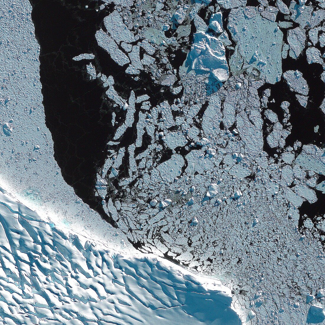
| Antarctic Peninsula. Satellite image of ice fields near Adelaide Island,Antarctica. Adelaide Island is a large,mainly ice-covered island,121 km long and 32 km wide,lying at the north side of Marguerite Bay off the west coast of the Antarctic Peninsula. Imaged by the GeoEye-1 satellite on 18th April 2012,from an altitude of 681 km above the Earth | |
| Lizenzart: | Lizenzpflichtig |
| Credit: | Science Photo Library / Geoeye |
| Bildgröße: | 3000 px × 3000 px |
| Modell-Rechte: | nicht erforderlich |
| Restrictions: | - |
Preise für dieses Bild ab 15 €
Universitäten & Organisationen
(Informationsmaterial Digital, Informationsmaterial Print, Lehrmaterial Digital etc.)
ab 15 €
Redaktionell
(Bücher, Bücher: Sach- und Fachliteratur, Digitale Medien (redaktionell) etc.)
ab 30 €
Werbung
(Anzeigen, Aussenwerbung, Digitale Medien, Fernsehwerbung, Karten, Werbemittel, Zeitschriften etc.)
ab 55 €
Handelsprodukte
(bedruckte Textilie, Kalender, Postkarte, Grußkarte, Verpackung etc.)
ab 75 €
Pauschalpreise
Rechtepakete für die unbeschränkte Bildnutzung in Print oder Online
ab 495 €
Keywords
- 1,
- 2012,
- 21. Jahrhundert,
- Antarktis,
- Antarktische Halbinsel,
- Eis,
- eisbedeckt,
- eisig,
- Erdbeobachtung,
- Felder,
- Gefroren,
- GeoEye-1,
- geografisch,
- Geographie,
- Kalt,
- Klimatologie,
- klimatologisch,
- Küste,
- Küsten-,
- Meereis,
- Meteorologie,
- meteorologisch,
- Satellit,
- Satellitenbild,
- Umwelt,
- Umweltwissenschaften,
- Wasser,
- Weltall