United States,satellite image
Bildnummer 11633768
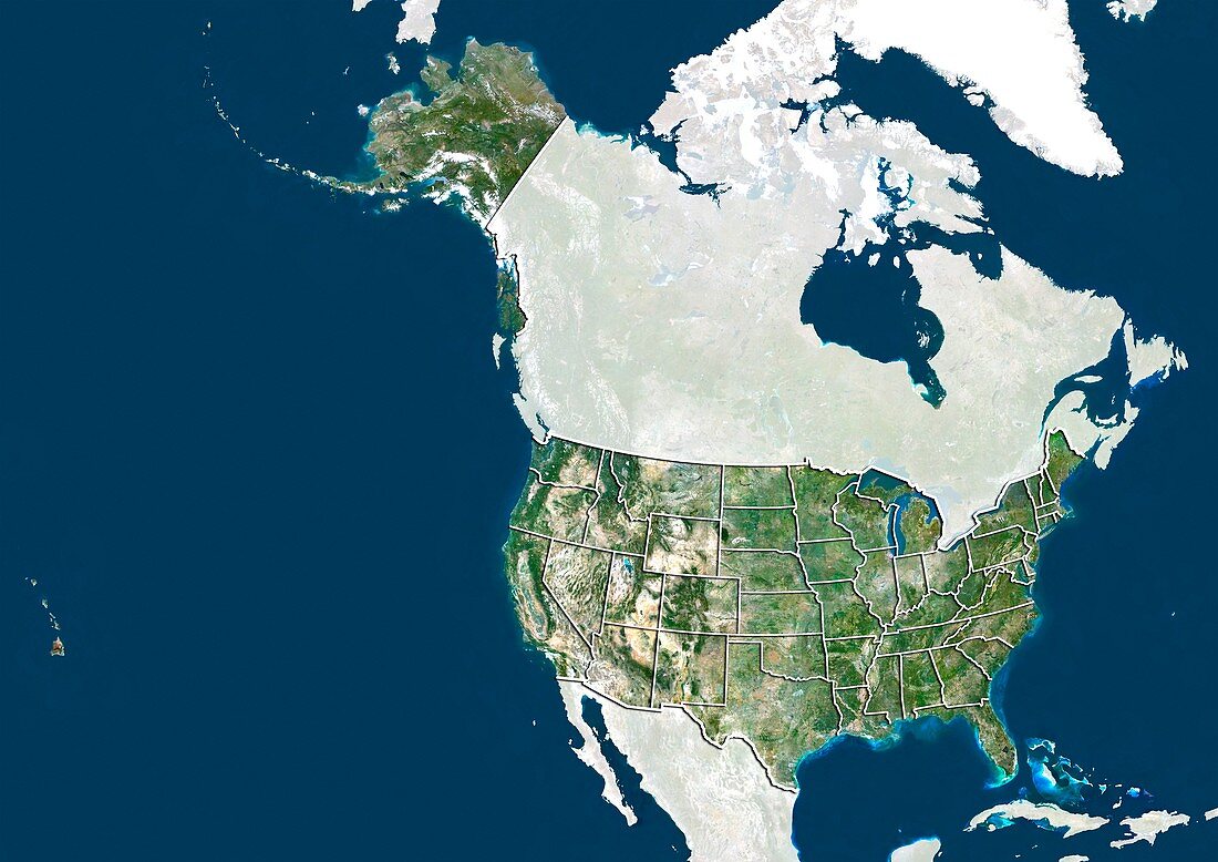
| United States,satellite image. North is at top. Natural colour satellite image showing the United States of America,divided into its states. The USA consists of 50 states. 48 are situated in southern North America (lower right),with the other two being Alaska (upper left) and Hawaii (islands,far left). It is bordered by Canada (upper centre) and Mexico (bottom centre). Cuba (bottom right),the Pacific Ocean (blue,left),the Atlantic Ocean (blue,right) and the Caribbean Sea (blue,bottom right) can also be seen. Image compiled from data acquired by the LANDSAT 5 and 7 satellites,in 2000 | |
| Lizenzart: | Lizenzpflichtig |
| Credit: | Science Photo Library / Planetobserver |
| Bildgröße: | 4978 px × 3523 px |
| Modell-Rechte: | nicht erforderlich |
| Restrictions: | - |
Preise für dieses Bild ab 15 €
Universitäten & Organisationen
(Informationsmaterial Digital, Informationsmaterial Print, Lehrmaterial Digital etc.)
ab 15 €
Redaktionell
(Bücher, Bücher: Sach- und Fachliteratur, Digitale Medien (redaktionell) etc.)
ab 30 €
Werbung
(Anzeigen, Aussenwerbung, Digitale Medien, Fernsehwerbung, Karten, Werbemittel, Zeitschriften etc.)
ab 55 €
Handelsprodukte
(bedruckte Textilie, Kalender, Postkarte, Grußkarte, Verpackung etc.)
ab 75 €
Pauschalpreise
Rechtepakete für die unbeschränkte Bildnutzung in Print oder Online
ab 495 €
Keywords
- 2000,
- 21. Jahrhundert,
- Alaska,
- Atlantisch,
- Erdbeobachtung,
- geografisch,
- Geographie,
- Grenze,
- Grenzen,
- Hawaii,
- Kanada,
- Karibisches Meer,
- Karte,
- Kartographie,
- Kuba,
- Küste,
- Küsten-,
- Küstenlinie,
- Land,
- Länder,
- Landsat 7,
- maskiert,
- Mexiko,
- Nation,
- Natur,
- Natürliche Farbe,
- Nordamerika,
- nordamerikanisch,
- Ozean,
- Pazifik,
- Rand,
- Satellit,
- Satellitenbild,
- Staat,
- topografisch,
- Topographie,
- Ufer,
- Umwelt,
- uns,
- USA,
- Vereinigte Staaten,
- Vogelperspektive,
- Von Oben,
- Weltall