Hurricane Norbert,satellite image
Bildnummer 11630376
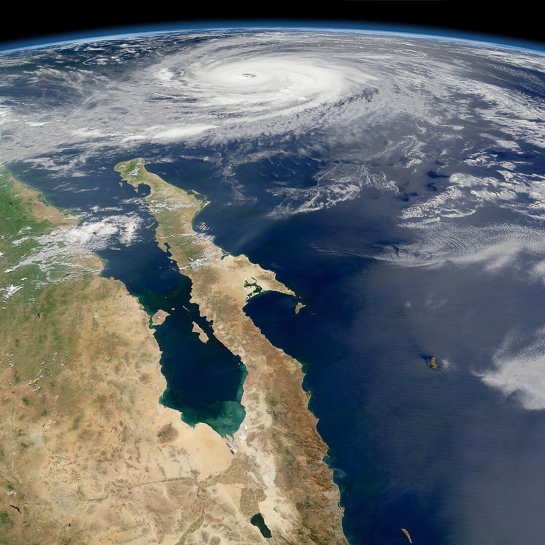
| Hurricane Norbert,satellite image. This view looks south over Baja California peninsula,Mexico,out into the Pacific Ocean at the rotating clouds (white) of Hurricane Norbert near the horizon. This storm,here hundreds of kilometres across,reached hurricane status on 8 October 2008,the same day this image was obtained. It made landfall in Baja California Sur (the southern portion of the peninsula) on 11 October,wreaking destruction and killing over 25 people. Image data obtained by the Moderate-resolution Imaging Spectroradiometer (MODIS) instrument on NASA's Aqua satellite,part of the Earth Observing System (EOS) | |
| Lizenzart: | Lizenzpflichtig |
| Credit: | Science Photo Library / NASA |
| Bildgröße: | 4205 px × 4205 px |
| Modell-Rechte: | nicht erforderlich |
| Eigentums-Rechte: | nicht erforderlich |
| Restrictions: | - |
Preise für dieses Bild ab 15 €
Universitäten & Organisationen
(Informationsmaterial Digital, Informationsmaterial Print, Lehrmaterial Digital etc.)
ab 15 €
Redaktionell
(Bücher, Bücher: Sach- und Fachliteratur, Digitale Medien (redaktionell) etc.)
ab 30 €
Werbung
(Anzeigen, Aussenwerbung, Digitale Medien, Fernsehwerbung, Karten, Werbemittel, Zeitschriften etc.)
ab 55 €
Handelsprodukte
(bedruckte Textilie, Kalender, Postkarte, Grußkarte, Verpackung etc.)
ab 75 €
Pauschalpreise
Rechtepakete für die unbeschränkte Bildnutzung in Print oder Online
ab 495 €
Keywords
- aqua,
- Baja California,
- Baja California Sur,
- Erdbeobachtung,
- geografisch,
- Geographie,
- Golf von Kalifornien,
- Halbinsel,
- Hurrikan,
- Kategorie 3,
- Krümmung,
- Kurve,
- Land,
- Meer,
- Meteorologie,
- meteorologisch,
- Mexikaner,
- Mexiko,
- modis,
- Natürliche Farbe,
- Nordamerika,
- nordamerikanisch,
- optisch,
- Ozean,
- Pazifik,
- rotierend,
- Satellit,
- Satellitenbild,
- Sichtbar,
- tödlich,
- Weltall,
- Wetter,
- Wolke,
- Wolken