United Arab Emirates,satellite image
Bildnummer 11629556
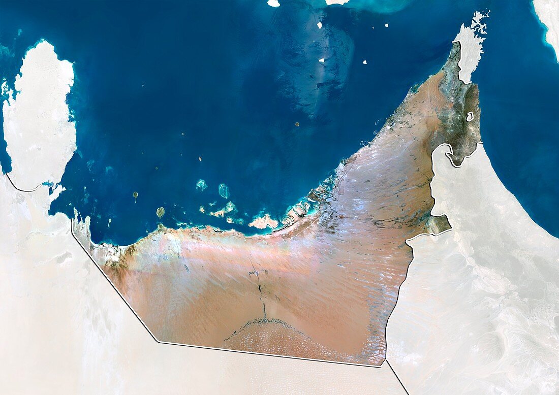
| United Arab Emirates,satellite image. North is at top. Natural colour satellite image showing the United Arab Emirates (UAE),with the surrounding territories shaded out. UAE is located in the southeast of the Arabian Peninsula in Western Asia,on the Persian Gulf (blue,top). It is bordered by Oman (lower right),and Saudi Arabia (lower left). Qatar (upper left) and the Gulf of Oman (blue,upper right) can also be seen. The UAE is a federation of seven emirates (principalities),each governed by a hereditary emir,with a single national president. The constituent emirates are: Abu Dhabi,Ajman,Dubai,Fujairah,Ras al-Khaimah,Sharjah,and Umm al-Quwain. Image compiled from data acquired by the LANDSAT 5 and 7 satellites,in 2000 | |
| Lizenzart: | Lizenzpflichtig |
| Credit: | Science Photo Library / Planetobserver |
| Bildgröße: | 4919 px × 3481 px |
| Modell-Rechte: | nicht erforderlich |
| Restrictions: | - |
Preise für dieses Bild ab 15 €
Universitäten & Organisationen
(Informationsmaterial Digital, Informationsmaterial Print, Lehrmaterial Digital etc.)
ab 15 €
Redaktionell
(Bücher, Bücher: Sach- und Fachliteratur, Digitale Medien (redaktionell) etc.)
ab 30 €
Werbung
(Anzeigen, Aussenwerbung, Digitale Medien, Fernsehwerbung, Karten, Werbemittel, Zeitschriften etc.)
ab 55 €
Handelsprodukte
(bedruckte Textilie, Kalender, Postkarte, Grußkarte, Verpackung etc.)
ab 75 €
Pauschalpreise
Rechtepakete für die unbeschränkte Bildnutzung in Print oder Online
ab 495 €
Keywords
- 2000,
- 21. Jahrhundert,
- Ajman,
- Arabische Halbinsel,
- Asiatisch,
- Asien,
- Erdbeobachtung,
- Fujairah,
- geografisch,
- Geographie,
- Golf von Oman,
- Grenze,
- Grenzen,
- Karte,
- Kartographie,
- Katar,
- Küste,
- Küsten-,
- Küstenlinie,
- Land,
- Länder,
- Landsat 7,
- maskiert,
- Mittlerer Osten,
- Nahost,
- Nation,
- Natur,
- Natürliche Farbe,
- Oman,
- Persischer Golf,
- Rand,
- Ras al-Khaimah,
- Satellit,
- Satellitenbild,
- Saudi Arabien,
- Staat,
- topografisch,
- Topographie,
- Ufer,
- Umwelt,
- Vereinigte Arabische Emirate,
- Vogelperspektive,
- Von Oben,
- Wasser,
- Weltall