Spain,satellite image
Bildnummer 11629519
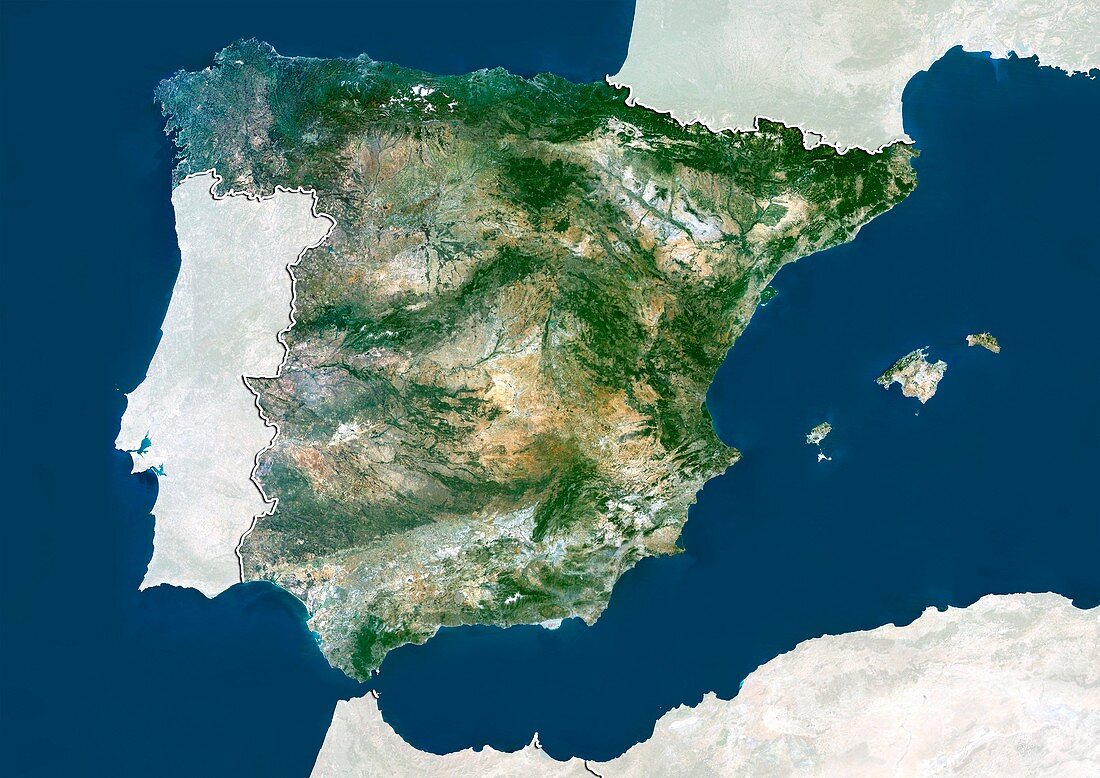
| Spain,satellite image. North is at top. Natural colour satellite image showing Spain,with the surrounding territories shaded out. Spain is situated in southwestern Europe on the Iberian Peninsula. It is bordered by Portugal (left),Andorra (small,upper right),France (upper right),the Mediterranean Sea (blue,right),and the Atlantic Ocean (blue,left). Spain is separated from Morocco (bottom centre),on mainland Africa,by the Strait of Gibraltar. Algeria (bottom right) and the Balearic Islands (centre right) of Mallorca,Menorca and Ibiza can also be seen. Image compiled from data acquired by the LANDSAT 5 and 7 satellites,in 2000 | |
| Lizenzart: | Lizenzpflichtig |
| Credit: | Science Photo Library / Planetobserver |
| Bildgröße: | 4919 px × 3481 px |
| Modell-Rechte: | nicht erforderlich |
| Restrictions: | - |
Preise für dieses Bild ab 15 €
Universitäten & Organisationen
(Informationsmaterial Digital, Informationsmaterial Print, Lehrmaterial Digital etc.)
ab 15 €
Redaktionell
(Bücher, Bücher: Sach- und Fachliteratur, Digitale Medien (redaktionell) etc.)
ab 30 €
Werbung
(Anzeigen, Aussenwerbung, Digitale Medien, Fernsehwerbung, Karten, Werbemittel, Zeitschriften etc.)
ab 55 €
Handelsprodukte
(bedruckte Textilie, Kalender, Postkarte, Grußkarte, Verpackung etc.)
ab 75 €
Pauschalpreise
Rechtepakete für die unbeschränkte Bildnutzung in Print oder Online
ab 495 €
Keywords
- 2000,
- 21. Jahrhundert,
- Afrika,
- Algerien,
- Atlantischer Ozean,
- Balearen,
- Erdbeobachtung,
- Europa,
- europäisch,
- Frankreich,
- geografisch,
- Geographie,
- Grenze,
- Grenzen,
- Iberische Halbinsel,
- Ibiza,
- Insel,
- Karte,
- Kartographie,
- Küste,
- Küsten-,
- Küstenlinie,
- Land,
- Länder,
- Landsat 7,
- Mallorca,
- Marokko,
- maskiert,
- Menorca,
- Mittelmeer,
- Nation,
- Natur,
- Natürliche Farbe,
- Portugal,
- Rand,
- Satellit,
- Satellitenbild,
- Spanien,
- Staat,
- Straße von Gibraltar,
- topografisch,
- Topographie,
- Ufer,
- Umwelt,
- Vogelperspektive,
- Von Oben,
- Weltall,
- Westeuropa