Puerto Rico,satellite image
Bildnummer 11629478
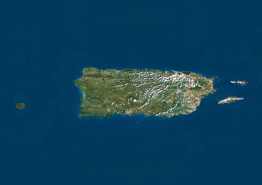
| Puerto Rico,satellite image. North is at top. Natural colour satellite image showing the island nation of Puerto Rico. Puerto Rico is an unincorporated territory of the United States that lies between the Caribbean Sea (blue,bottom) and North Atlantic Ocean (blue,top),east of the Dominican Republic and west of both the United States Virgin Islands and the British Virgin Islands. It consists of an archipelago that includes the main island of Puerto Rico (large,centre) and a number of smaller islands,the largest being Vieques,Culebra,and Mona. It is part of the West Indies islands known as the Greater Antilles. Image compiled from data acquired by the LANDSAT 5 and 7 satellites,in 2000 | |
| Lizenzart: | Lizenzpflichtig |
| Credit: | Science Photo Library / Planetobserver |
| Bildgröße: | 4919 px × 3481 px |
| Modell-Rechte: | nicht erforderlich |
| Restrictions: | - |
Preise für dieses Bild ab 15 €
Universitäten & Organisationen
(Informationsmaterial Digital, Informationsmaterial Print, Lehrmaterial Digital etc.)
ab 15 €
Redaktionell
(Bücher, Bücher: Sach- und Fachliteratur, Digitale Medien (redaktionell) etc.)
ab 30 €
Werbung
(Anzeigen, Aussenwerbung, Digitale Medien, Fernsehwerbung, Karten, Werbemittel, Zeitschriften etc.)
ab 55 €
Handelsprodukte
(bedruckte Textilie, Kalender, Postkarte, Grußkarte, Verpackung etc.)
ab 75 €
Pauschalpreise
Rechtepakete für die unbeschränkte Bildnutzung in Print oder Online
ab 495 €
Keywords
- 2000,
- 21. Jahrhundert,
- Amerika,
- Amerikanisch,
- Archipel,
- Erdbeobachtung,
- geografisch,
- Geographie,
- Grenze,
- Grenzen,
- Insel,
- Inseln,
- Karibisches Meer,
- Karte,
- Kartographie,
- Küste,
- Küsten-,
- Küstenlinie,
- Land,
- Länder,
- Landsat 7,
- maskiert,
- Mona,
- Nation,
- Natur,
- Natürliche Farbe,
- Puerto Rico,
- Rand,
- Satellit,
- Satellitenbild,
- Staat,
- topografisch,
- Topographie,
- Ufer,
- Umwelt,
- uns,
- USA,
- Vereinigte Staaten,
- Vogelperspektive,
- Von Oben,
- Weltall,
- Westindische Inseln