Ireland,satellite image
Bildnummer 11623945
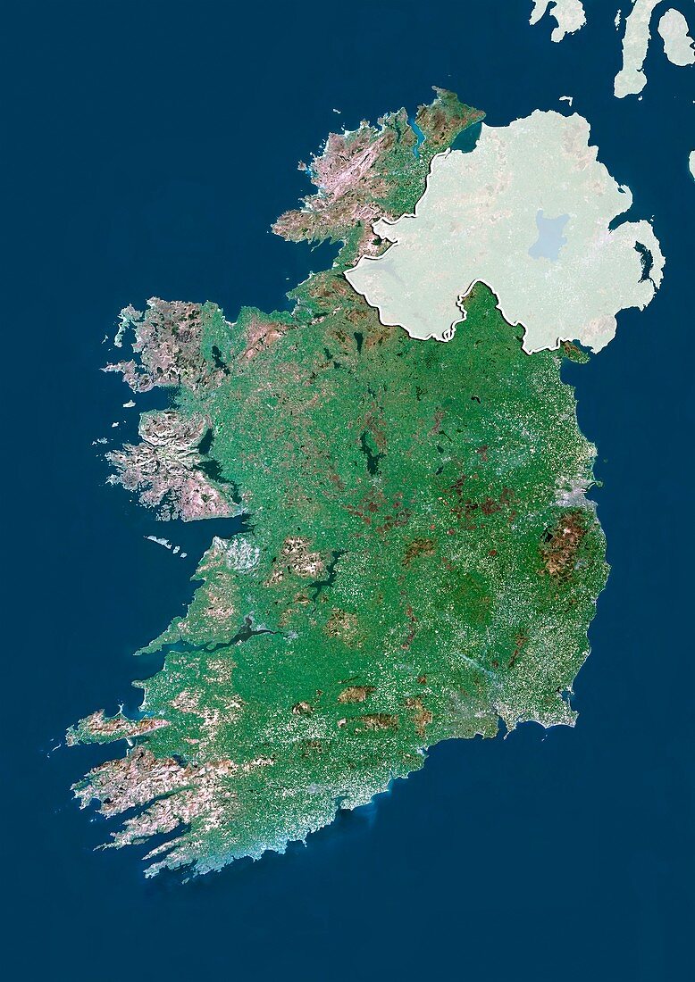
| Ireland,satellite image. North is at top. Natural colour satellite image showing Ireland (green) with Northern Ireland shaded out. The Atlantic Ocean (blue,left),Irish Sea (blue,right) and Celtic Sea (blue,bottom) can also be seen. Ireland is an island to the northwest of continental Europe and shares a border with Northern Ireland,which is part of the UK. Image compiled from data acquired by the LANDSAT 5 and 7 satellites,in 2000 | |
| Lizenzart: | Lizenzpflichtig |
| Credit: | Science Photo Library / Planetobserver |
| Bildgröße: | 3482 px × 4920 px |
| Modell-Rechte: | nicht erforderlich |
| Restrictions: | - |
Preise für dieses Bild ab 15 €
Universitäten & Organisationen
(Informationsmaterial Digital, Informationsmaterial Print, Lehrmaterial Digital etc.)
ab 15 €
Redaktionell
(Bücher, Bücher: Sach- und Fachliteratur, Digitale Medien (redaktionell) etc.)
ab 30 €
Werbung
(Anzeigen, Aussenwerbung, Digitale Medien, Fernsehwerbung, Karten, Werbemittel, Zeitschriften etc.)
ab 55 €
Handelsprodukte
(bedruckte Textilie, Kalender, Postkarte, Grußkarte, Verpackung etc.)
ab 75 €
Pauschalpreise
Rechtepakete für die unbeschränkte Bildnutzung in Print oder Online
ab 495 €
Keywords
- 2000,
- 21. Jahrhundert,
- Atlantischer Ozean,
- Britische Inseln,
- Erdbeobachtung,
- Europa,
- europäisch,
- geografisch,
- Geographie,
- Grenze,
- Grenzen,
- Insel,
- Irische See,
- Irland,
- Karte,
- Kartographie,
- Keltische See,
- Küste,
- Küsten-,
- Küstenlinie,
- Land,
- Länder,
- Landsat 7,
- maskiert,
- Nation,
- Natur,
- Natürliche Farbe,
- Nordirland,
- Rand,
- Satellit,
- Satellitenbild,
- Staat,
- topografisch,
- Topographie,
- Ufer,
- Umwelt,
- Vereinigtes Königreich,
- Vogelperspektive,
- Von Oben,
- Weltall,
- wolkenlos