Mediterranean Sea,14th century
Bildnummer 11613977
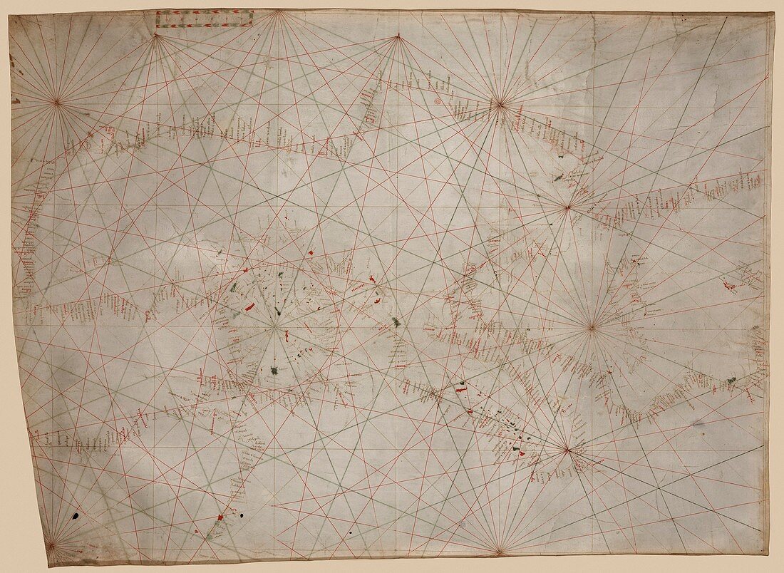
| Mediterranean Sea,14th century. North is at bottom. This portolan chart was produced in around 1320-1350,probably in Genoa,Italy. It ranges from the Balearic Islands (far right) to the Levantine coast (far left),and also covers the western part of the Black Sea (bottom left). Venice and Italy are at lower right,Greece at centre left,and the North African coast is across top. Portolan charts are nautical charts with harbours and coasts labelled (here in Latin). The lines on the map are rhumb lines,designed to make it easier to steer a straight course. This manuscript chart made on vellum is the oldest original map held at the Library of Congress | |
| Lizenzart: | Lizenzpflichtig |
| Credit: | Science Photo Library / Library of Congress |
| Bildgröße: | 5362 px × 3919 px |
| Modell-Rechte: | nicht erforderlich |
| Eigentums-Rechte: | nicht erforderlich |
| Restrictions: | - |
Preise für dieses Bild ab 15 €
Universitäten & Organisationen
(Informationsmaterial Digital, Informationsmaterial Print, Lehrmaterial Digital etc.)
ab 15 €
Redaktionell
(Bücher, Bücher: Sach- und Fachliteratur, Digitale Medien (redaktionell) etc.)
ab 30 €
Werbung
(Anzeigen, Aussenwerbung, Digitale Medien, Fernsehwerbung, Karten, Werbemittel, Zeitschriften etc.)
ab 55 €
Handelsprodukte
(bedruckte Textilie, Kalender, Postkarte, Grußkarte, Verpackung etc.)
ab 75 €
Pauschalpreise
Rechtepakete für die unbeschränkte Bildnutzung in Print oder Online
ab 495 €
Keywords
- 14. Jahrhundert,
- Balearen,
- Diagramm,
- Europa,
- europäisch,
- Genua,
- geografisch,
- Geographie,
- Geschichte,
- Griechenland,
- historisch,
- Illustration,
- Italien,
- Italienisch,
- Karte,
- Kartographie,
- Kunstwerk,
- Meer,
- Mittelalterlich,
- Mittelmeer,
- mittleren Alters,
- Mittlerer Osten,
- Nahost,
- Nautisch,
- Nordafrika,
- Ozean,
- schwarzes Meer,
- Truthahn,
- Venedig