El Hierro,Canary Islands
Bildnummer 11608436
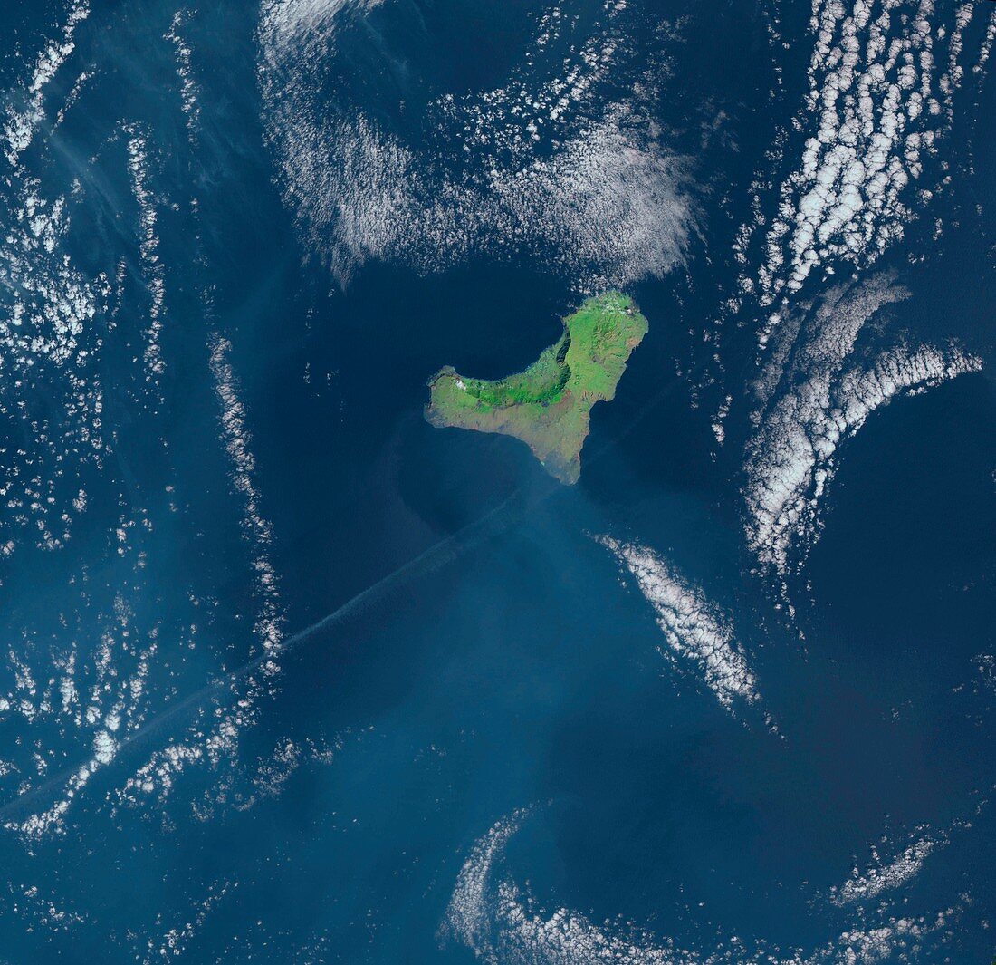
| El Hierro,Canary Islands,satellite image. North is at top. Clouds are white,water is blue,and vegetation on land is green. El Hierro is a volcanic island,the smallest of the Canary Islands,located in the Atlantic Ocean near Africa. It is less than 50 kilometres across. The north-western side of the island is dominated by the cliffs and lowlands of the El Golfo valley,some 10 kilometres across,formed by ancient landslides. Image data obtained in March 2007 by the Thematic Mapper (TM) instruments on the Landsat 4 and Landsat 5 satellites | |
| Lizenzart: | Lizenzpflichtig |
| Credit: | Science Photo Library / US Geological Survey |
| Bildgröße: | 4252 px × 4116 px |
| Modell-Rechte: | nicht erforderlich |
| Eigentums-Rechte: | nicht erforderlich |
| Restrictions: | - |
Preise für dieses Bild ab 15 €
Universitäten & Organisationen
(Informationsmaterial Digital, Informationsmaterial Print, Lehrmaterial Digital etc.)
ab 15 €
Redaktionell
(Bücher, Bücher: Sach- und Fachliteratur, Digitale Medien (redaktionell) etc.)
ab 30 €
Werbung
(Anzeigen, Aussenwerbung, Digitale Medien, Fernsehwerbung, Karten, Werbemittel, Zeitschriften etc.)
ab 55 €
Handelsprodukte
(bedruckte Textilie, Kalender, Postkarte, Grußkarte, Verpackung etc.)
ab 75 €
Pauschalpreise
Rechtepakete für die unbeschränkte Bildnutzung in Print oder Online
ab 495 €
Keywords
- 21. Jahrhundert,
- Alter,
- Atlantischer Ozean,
- Erdbeobachtung,
- Erdrutsch,
- europäisch,
- geografisch,
- Geographie,
- Geologie,
- geologisch,
- Insel,
- Kanarische Inseln,
- Klippe,
- Klippen,
- Küste,
- Küsten-,
- Küstenlinie,
- März,
- Meer,
- Ozean,
- Satellitenbild,
- Sediment,
- Spanien,
- spanisch,
- Tal,
- Tm,
- Vegetation,
- vulkanisch,
- Vulkanologie,
- Weltall,
- Wolke,
- Wolken