Earth,topographic and bathymetric map
Bildnummer 11602847
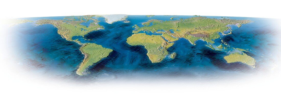
| Earth,topographic and bathymetric map. Computer generated image showing the varying heights and depths of the World's landmasses,oceans and seas | |
| Lizenzart: | Lizenzpflichtig |
| Credit: | Science Photo Library / Lunau, Claus |
| Bildgröße: | 4843 px × 1943 px |
| Modell-Rechte: | nicht erforderlich |
| Eigentums-Rechte: | nicht erforderlich |
| Restrictions: | - |
Preise für dieses Bild ab 15 €
Universitäten & Organisationen
(Informationsmaterial Digital, Informationsmaterial Print, Lehrmaterial Digital etc.)
ab 15 €
Redaktionell
(Bücher, Bücher: Sach- und Fachliteratur, Digitale Medien (redaktionell) etc.)
ab 30 €
Werbung
(Anzeigen, Aussenwerbung, Digitale Medien, Fernsehwerbung, Karten, Werbemittel, Zeitschriften etc.)
ab 55 €
Handelsprodukte
(bedruckte Textilie, Kalender, Postkarte, Grußkarte, Verpackung etc.)
ab 75 €
Pauschalpreise
Rechtepakete für die unbeschränkte Bildnutzung in Print oder Online
ab 495 €
Keywords
- abgebildet,
- Afrika,
- Altimetrie,
- altimetrisch,
- Bathymetrie,
- bathymetrisch,
- Becken,
- Berge,
- Daten,
- Ebenen,
- Erde,
- geografisch,
- Geographie,
- Globus,
- Grat,
- Höhe,
- Illustration,
- Karte,
- Kontinent,
- Kontinente,
- Kunstwerk,
- Land,
- Marine,
- Meer,
- Meeresboden,
- Meereskunde,
- Modell-,
- Ozean,
- Ozeane,
- ozeanisch,
- Pazifik,
- Planet,
- Regale,
- Region,
- Tiefe,
- topografisch,
- Topographie,
- weißer Hintergrund,
- Welt,
- weltweit