Pacific Ocean bathymetry
Bildnummer 11600107
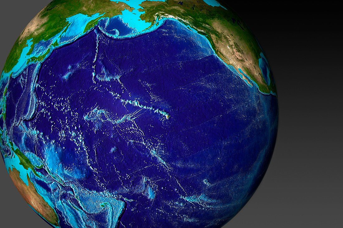
| Pacific Ocean bathymetry. Computer map of ocean floor depth (bathymetry) in the Pacific Ocean,with depth colour-coded from shallow (light blue) to deep (dark blue). The peaks are underwater mountains and volcanoes,some of which rise above the water to form islands. This model forms the basis for C008/9972,which shows the wave heights of the tsunami that devastated north-eastern Japan following the large offshore earthquake of 11 March 2011. This tsunami spread through the entire Pacific in around 20 hours. This map was produced by the Center for Tsunami Research at NOAA's Pacific Marine Environmental Laboratory.<br>Restrictions: | |
| Lizenzart: | Lizenzpflichtig |
| Credit: | Science Photo Library / NOAA |
| Bildgröße: | 3661 px × 2441 px |
| Modell-Rechte: | nicht erforderlich |
| Eigentums-Rechte: | nicht erforderlich |
| Restrictions: |
|
Preise für dieses Bild ab 15 €
Universitäten & Organisationen
(Informationsmaterial Digital, Informationsmaterial Print, Lehrmaterial Digital etc.)
ab 15 €
Redaktionell
(Bücher, Bücher: Sach- und Fachliteratur, Digitale Medien (redaktionell) etc.)
ab 30 €
Werbung
(Anzeigen, Aussenwerbung, Digitale Medien, Fernsehwerbung, Karten, Werbemittel, Zeitschriften etc.)
ab 55 €
Handelsprodukte
(bedruckte Textilie, Kalender, Postkarte, Grußkarte, Verpackung etc.)
ab 75 €
Pauschalpreise
Rechtepakete für die unbeschränkte Bildnutzung in Print oder Online
ab 495 €