Gezira irrigation scheme,satellite image
Bildnummer 11592951
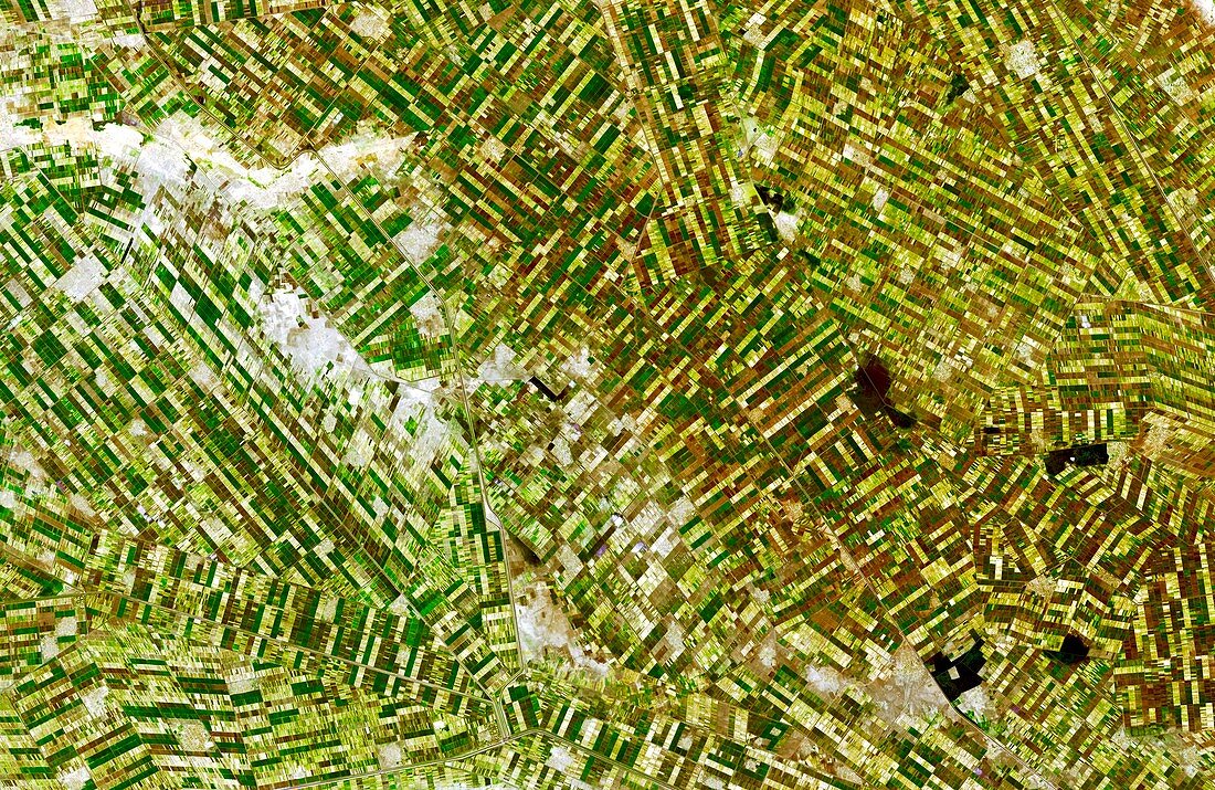
| Gezira irrigation scheme,satellite image. North is at top. This patchwork of irrigated fields is located in the state of Al Jazirah,Sudan,where the White Nile and the Blue Nile join. There are thousands of kilometres of canals and ditches bringing water from the Blue Nile. This project,one of the largest irrigation systems in the world,was started in the first half of the 20th century,and completed in the 1950s and 1960s. The major crop here is cotton. This image,some 60 kilometres across,was obtained by the Advanced Spaceborne Thermal Emission and Reflection Radiometer (ASTER) on NASA's Terra satellite,on 25 December 2006 | |
| Lizenzart: | Lizenzpflichtig |
| Credit: | Science Photo Library / ASTER SCIENCE TEAM / JAROS / ERSDAC / METI / GSFC / NASA |
| Bildgröße: | 5267 px × 3425 px |
| Modell-Rechte: | nicht erforderlich |
| Eigentums-Rechte: | nicht erforderlich |
| Restrictions: | - |
Preise für dieses Bild ab 15 €
Universitäten & Organisationen
(Informationsmaterial Digital, Informationsmaterial Print, Lehrmaterial Digital etc.)
ab 15 €
Redaktionell
(Bücher, Bücher: Sach- und Fachliteratur, Digitale Medien (redaktionell) etc.)
ab 30 €
Werbung
(Anzeigen, Aussenwerbung, Digitale Medien, Fernsehwerbung, Karten, Werbemittel, Zeitschriften etc.)
ab 55 €
Handelsprodukte
(bedruckte Textilie, Kalender, Postkarte, Grußkarte, Verpackung etc.)
ab 75 €
Pauschalpreise
Rechtepakete für die unbeschränkte Bildnutzung in Print oder Online
ab 495 €
Keywords
- 1900er Jahre,
- 1960er Jahre,
- 20. Jahrhundert,
- 21. Jahrhundert,
- Afrika,
- Afrikanisch,
- Aster,
- Bauernhof,
- Bauernhöfe,
- Baumwolle,
- Blauer Nil,
- Bodennutzung,
- Dezember,
- Ernte,
- Feld,
- Felder,
- Feldfrüchte,
- Fruchtbar,
- geografisch,
- groß,
- größte,
- Grün,
- Kanal,
- Landwirtschaft,
- landwirtschaftlich,
- mehrere,
- Patchwork,
- Satellit,
- Satellitenbild,
- Straße,
- Technologie,
- technologisch,
- Terra,
- Üppig,
- viele,
- weißer Nil,
- Weltall,
- Weltgrößtes