Portuguese sea chart,16th century
Bildnummer 11592261
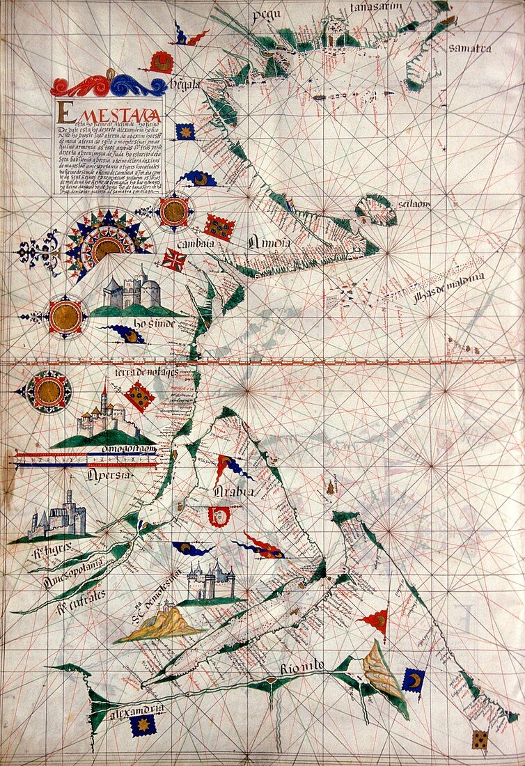
| Portuguese sea chart. 16th century nautical chart of the coastlines of the Indian Ocean. North is at left. The chart shows the names of locations along the coastlines,and gives lines used for navigation at sea. Sumatra is at top right,India at upper centre,and the Arabian Peninsula at lower left. Nautical charts such as these were used during the Age of Discovery,that included the 1497-9 voyage of the Portuguese explorer Vasco da Gama,which opened the maritime trading route from Europe to India. This map is from a 1563 atlas by the Portuguese cartographer Lazaro Luis. The atlas is held at the Sciences Academy of Lisbon | |
| Lizenzart: | Lizenzpflichtig |
| Credit: | Science Photo Library / Landmann, Patrick |
| Bildgröße: | 3486 px × 5087 px |
| Modell-Rechte: | nicht erforderlich |
| Eigentums-Rechte: | nicht erforderlich |
| Restrictions: | - |
Preise für dieses Bild ab 15 €
Universitäten & Organisationen
(Informationsmaterial Digital, Informationsmaterial Print, Lehrmaterial Digital etc.)
ab 15 €
Redaktionell
(Bücher, Bücher: Sach- und Fachliteratur, Digitale Medien (redaktionell) etc.)
ab 30 €
Werbung
(Anzeigen, Aussenwerbung, Digitale Medien, Fernsehwerbung, Karten, Werbemittel, Zeitschriften etc.)
ab 55 €
Handelsprodukte
(bedruckte Textilie, Kalender, Postkarte, Grußkarte, Verpackung etc.)
ab 75 €
Pauschalpreise
Rechtepakete für die unbeschränkte Bildnutzung in Print oder Online
ab 495 €
Keywords
- 1500er Jahre,
- 16. Jahrhundert,
- Afrikanisch,
- Arabien,
- Arabische Halbinsel,
- Asiatisch,
- Asien,
- Blatt,
- Diagramm,
- Erkundung,
- Europa,
- europäisch,
- Flagge,
- Flaggen,
- geografisch,
- Geographie,
- Geschichte,
- historisch,
- Illustration,
- Indien,
- Indisch,
- Indischer Ozean,
- Indonesien,
- Indonesisch,
- Karte,
- Kartographie,
- Kontinent,
- Kunstwerk,
- Küste,
- Küsten-,
- Lazaro luis,
- Lissabon,
- Manuskript,
- Nautisch,
- Ostafrika,
- Ozean,
- Portugal,
- Portugiesisch,
- Region,
- Sumatra