West Mata underwater volcano,bathymetry
Bildnummer 11584480
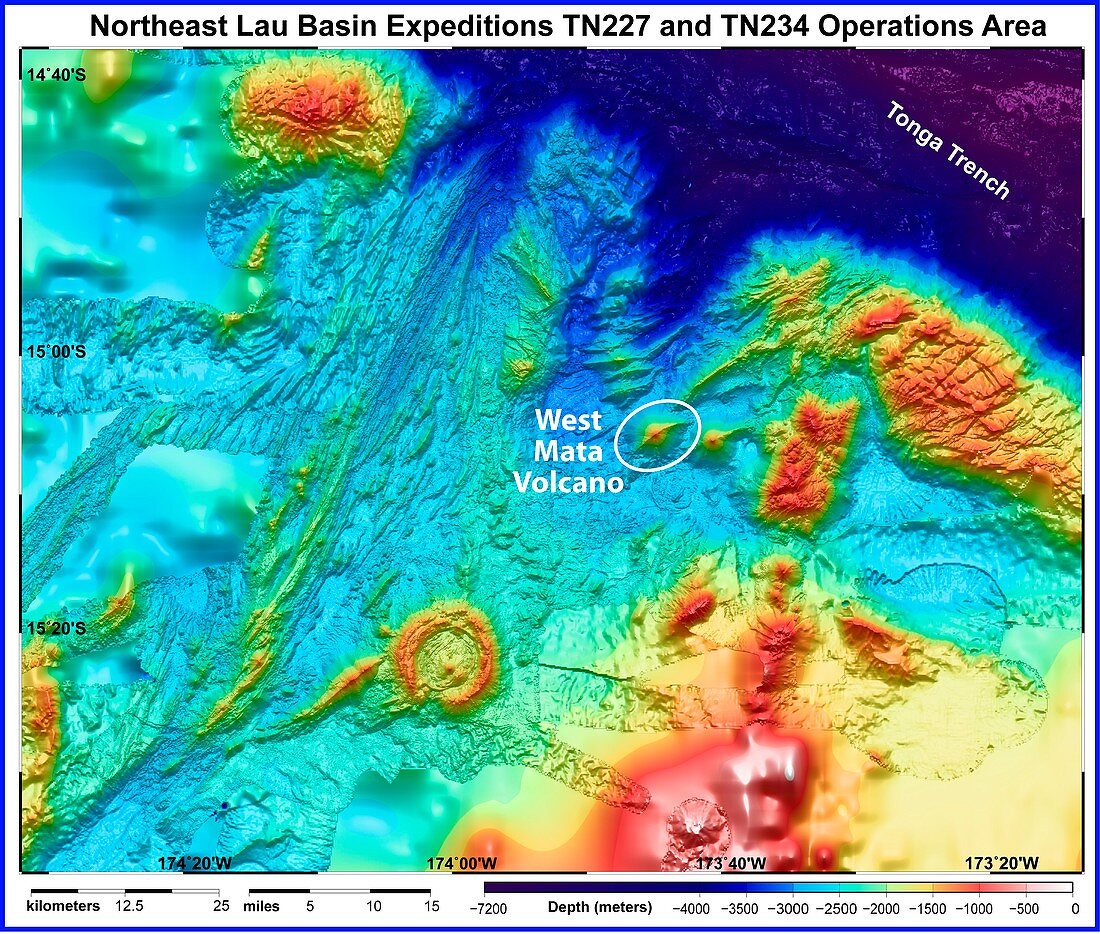
| West Mata underwater volcano. Bathymetric map of the bed of the northeast Lau Basin in the south Pacific Ocean with the West Mata volcano circled. West Mata was discovered in May 2009 and is the deepest erupting volcano yet discovered. It lies 4000 feet (1.2 kilometres) below the surface of the Pacific Ocean,in an area bounded by Fiji,Tonga and Samoa. Bathymetric information is gathered using an echosounder (sonar),where a beam of sound is emitted downwards into the ocean and the time taken for it to bounce off the sea floor and return is recorded | |
| Lizenzart: | Lizenzpflichtig |
| Credit: | Science Photo Library / NOAA |
| Bildgröße: | 4548 px × 3862 px |
| Modell-Rechte: | nicht erforderlich |
| Eigentums-Rechte: | nicht erforderlich |
| Restrictions: |
|
Preise für dieses Bild ab 15 €
Universitäten & Organisationen
(Informationsmaterial Digital, Informationsmaterial Print, Lehrmaterial Digital etc.)
ab 15 €
Redaktionell
(Bücher, Bücher: Sach- und Fachliteratur, Digitale Medien (redaktionell) etc.)
ab 30 €
Werbung
(Anzeigen, Aussenwerbung, Digitale Medien, Fernsehwerbung, Karten, Werbemittel, Zeitschriften etc.)
ab 55 €
Handelsprodukte
(bedruckte Textilie, Kalender, Postkarte, Grußkarte, Verpackung etc.)
ab 75 €
Pauschalpreise
Rechtepakete für die unbeschränkte Bildnutzung in Print oder Online
ab 495 €