Majorca,Spain,satellite image
Bildnummer 11566544
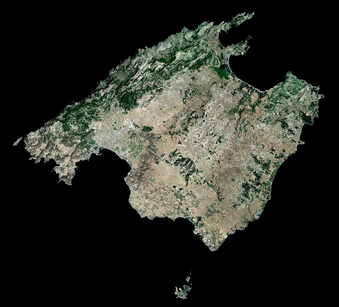
| Majorca,Spain. Satellite image of the Spanish island of Majorca. North is at top. Majorca is the largest of the Balearic islands and the largest island of Spain. The Balearics are located in the Mediterranean Sea near the eastern coast of the Iberian Peninsula. Forested areas are dark green,bare ground is brown,urban areas are grey,and water is black. Image created using NaturalVue data obtained from the Landsat 7 satellite | |
| Lizenzart: | Lizenzpflichtig |
| Credit: | Science Photo Library / MDA Information Systems |
| Bildgröße: | 4425 px × 4016 px |
| Modell-Rechte: | nicht erforderlich |
| Eigentums-Rechte: | nicht erforderlich |
| Restrictions: | - |
Preise für dieses Bild ab 15 €
Universitäten & Organisationen
(Informationsmaterial Digital, Informationsmaterial Print, Lehrmaterial Digital etc.)
ab 15 €
Redaktionell
(Bücher, Bücher: Sach- und Fachliteratur, Digitale Medien (redaktionell) etc.)
ab 30 €
Werbung
(Anzeigen, Aussenwerbung, Digitale Medien, Fernsehwerbung, Karten, Werbemittel, Zeitschriften etc.)
ab 55 €
Handelsprodukte
(bedruckte Textilie, Kalender, Postkarte, Grußkarte, Verpackung etc.)
ab 75 €
Pauschalpreise
Rechtepakete für die unbeschränkte Bildnutzung in Print oder Online
ab 495 €
Keywords
- Balearen,
- balearisch,
- Erdbeobachtung,
- Europa,
- europäisch,
- geografisch,
- Geographie,
- Insel,
- Inseln,
- Küste,
- Küsten-,
- Küstenlinie,
- Landsat 7,
- Mallorca,
- Meer,
- NASA,
- NaturalVue,
- Natürliche Farbe,
- Ozean,
- Pozzuoli,
- Satellit,
- Satellitenbild,
- Spanien,
- spanisch,
- Stadt,
- städtisch,
- Urbanisierung,
- Vegetation,
- Vulkan,
- vulkanisch,
- Wald,
- Wälder,
- Wasser,
- Weltall