The Bahamas,satellite image
Bildnummer 11564036
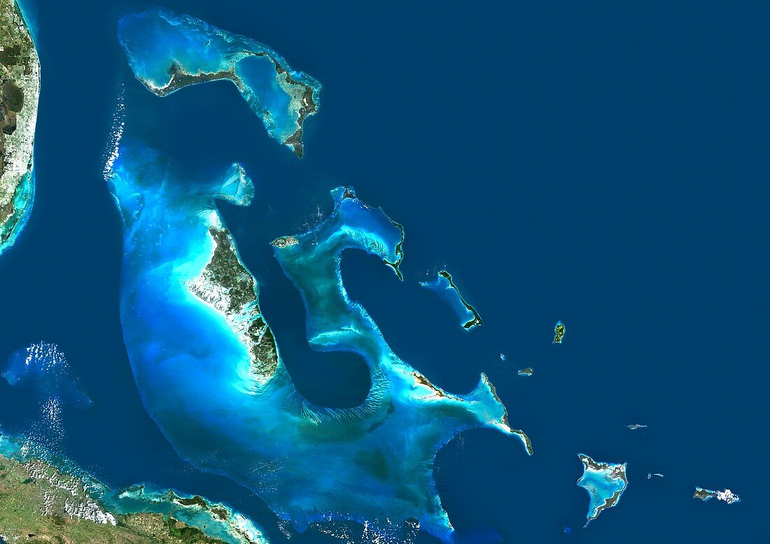
| The Bahamas,satellite image. North is at top. Water is blue,vegetation is brown and green,beaches are white,and clouds are white. Deep ocean is blue,with shallow areas and sand banks appearing as light blue. The Bahamas,an archipelago of 29 islands located in the northern Caribbean Sea,is several hundred kilometres across. The largest island (Andros,centre left) has the Great Bahama Bank (pale blue) to its left. Image data obtained by the Landsat 5 and Landsat 7 satellites | |
| Lizenzart: | Lizenzpflichtig |
| Credit: | Science Photo Library / Planetobserver |
| Bildgröße: | 4978 px × 3520 px |
| Modell-Rechte: | nicht erforderlich |
| Eigentums-Rechte: | nicht erforderlich |
| Restrictions: | - |
Preise für dieses Bild ab 15 €
Universitäten & Organisationen
(Informationsmaterial Digital, Informationsmaterial Print, Lehrmaterial Digital etc.)
ab 15 €
Redaktionell
(Bücher, Bücher: Sach- und Fachliteratur, Digitale Medien (redaktionell) etc.)
ab 30 €
Werbung
(Anzeigen, Aussenwerbung, Digitale Medien, Fernsehwerbung, Karten, Werbemittel, Zeitschriften etc.)
ab 55 €
Handelsprodukte
(bedruckte Textilie, Kalender, Postkarte, Grußkarte, Verpackung etc.)
ab 75 €
Pauschalpreise
Rechtepakete für die unbeschränkte Bildnutzung in Print oder Online
ab 495 €
Keywords
- Archipel,
- Bahamas,
- Erdbeobachtung,
- geografisch,
- Geographie,
- Geowissenschaften,
- Grand Bahama,
- Grenzen,
- Insel,
- Inseln,
- Karibik,
- Karibisches Meer,
- Kartographie,
- Küste,
- Küsten-,
- Küstenlinie,
- Land,
- Landsat 7,
- Meer,
- Nation,
- Nordamerika,
- nordamerikanisch,
- Ozean,
- Rand,
- Satellit,
- Satellitenbild,
- Topographie,
- Umwelt,
- Wasser,
- Weltall,
- Westindische Inseln