Monterey bay,3-D image
Bildnummer 11562270
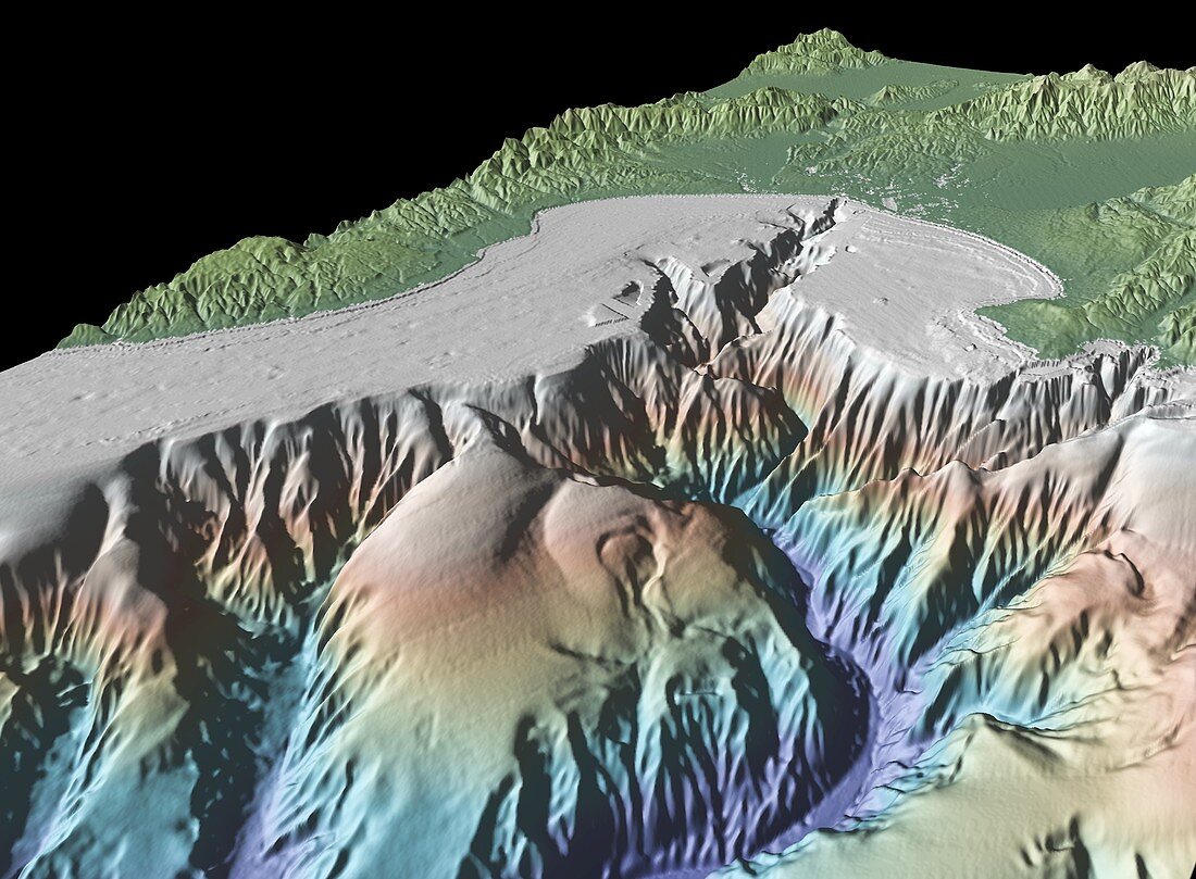
| Monterey bay. 3-D satellite and bathymetry image of Monterey bay,USA. It was produced using GeoMapApp,a geophysical visualisation program at the Lamont-Doherty Earth Observatory of Columbia University,USA,using data from the Shuttle Radar Topographic Mission (SRTM) and shipboard bathymetry measurments. The image shows seafloor topography (lower half) and land topography (upper half) | |
| Lizenzart: | Lizenzpflichtig |
| Credit: | Science Photo Library / GEOMAPAPP / RYAN ET AL |
| Bildgröße: | 4000 px × 2941 px |
| Modell-Rechte: | nicht erforderlich |
| Eigentums-Rechte: | nicht erforderlich |
| Restrictions: | - |
Preise für dieses Bild ab 15 €
Universitäten & Organisationen
(Informationsmaterial Digital, Informationsmaterial Print, Lehrmaterial Digital etc.)
ab 15 €
Redaktionell
(Bücher, Bücher: Sach- und Fachliteratur, Digitale Medien (redaktionell) etc.)
ab 30 €
Werbung
(Anzeigen, Aussenwerbung, Digitale Medien, Fernsehwerbung, Karten, Werbemittel, Zeitschriften etc.)
ab 55 €
Handelsprodukte
(bedruckte Textilie, Kalender, Postkarte, Grußkarte, Verpackung etc.)
ab 75 €
Pauschalpreise
Rechtepakete für die unbeschränkte Bildnutzung in Print oder Online
ab 495 €