Hurricane Katrina sea surface temperature
Bildnummer 11562037
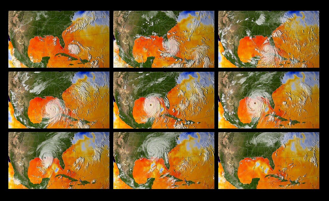
| Hurricane Katrina sea surface temperature. Satellite image of Hurricane Katrina superimposed over sea surface temperature between 24th August 2005 (top left) and 30th August 2005 (lower right). Hurricanes form over warm water and are sustained by the heat energy of the ocean. In this image,red and orange represents warm water and blue represents cold water. Katrina originates in over the Caribbean ocean and travels west,growing larger each day. By the time it was reached Louisiana it has left a wake of colder water (centre). Katrina caused immense damage and flooding and killed over 1800 people. The city of New Orleans was all but destroyed by the hurricane | |
| Lizenzart: | Lizenzpflichtig |
| Credit: | Science Photo Library / NASA |
| Bildgröße: | 4167 px × 2544 px |
| Modell-Rechte: | nicht erforderlich |
| Eigentums-Rechte: | nicht erforderlich |
| Restrictions: | - |
Preise für dieses Bild ab 15 €
Universitäten & Organisationen
(Informationsmaterial Digital, Informationsmaterial Print, Lehrmaterial Digital etc.)
ab 15 €
Redaktionell
(Bücher, Bücher: Sach- und Fachliteratur, Digitale Medien (redaktionell) etc.)
ab 30 €
Werbung
(Anzeigen, Aussenwerbung, Digitale Medien, Fernsehwerbung, Karten, Werbemittel, Zeitschriften etc.)
ab 55 €
Handelsprodukte
(bedruckte Textilie, Kalender, Postkarte, Grußkarte, Verpackung etc.)
ab 75 €
Pauschalpreise
Rechtepakete für die unbeschränkte Bildnutzung in Print oder Online
ab 495 €
Keywords
- 21. Jahrhundert,
- Amerikanisch,
- Atlantisch,
- Erdbeobachtung,
- extremes Wetter,
- geografisch,
- Geographie,
- Golf von Mexiko,
- Hurrikan,
- Karibik,
- Katastrophe,
- Klimatologie,
- klimatologisch,
- Landung,
- Meer,
- Meteorologie,
- meteorologisch,
- Naturkatastrophe,
- Nordamerika,
- Ozean,
- Reihenfolge,
- Satellit,
- Satellitenbild,
- sst,
- Sturm,
- stürmisch,
- Unwetter,
- USA,
- Vereinigte Staaten,
- Westindische Inseln,
- Wetter,
- Zentralamerika