LIDAR laser atmospheric research
Bildnummer 11561761
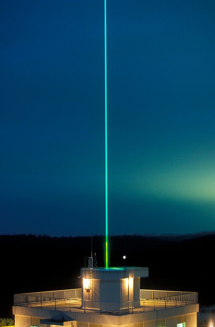
| LIDAR laser atmospheric research. LIDAR (Light Detection and Ranging) laser beam shining into the night sky. LIDAR is a remote sensing technology that can be used to study and measure atmospheric properties such as density,temperature,wind,turbulence and composition. This Rayleigh LIDAR can fire a laser beam to heights of 100 kilometres. Photographed at the CEL (Centre d'Essais des Landes) research centre in France | |
| Lizenzart: | Lizenzpflichtig |
| Credit: | Science Photo Library / Landmann, Patrick |
| Bildgröße: | 3425 px × 5197 px |
| Modell-Rechte: | nicht erforderlich |
| Eigentums-Rechte: | nicht erforderlich |
| Restrictions: | - |
Preise für dieses Bild ab 15 €
Universitäten & Organisationen
(Informationsmaterial Digital, Informationsmaterial Print, Lehrmaterial Digital etc.)
ab 15 €
Redaktionell
(Bücher, Bücher: Sach- und Fachliteratur, Digitale Medien (redaktionell) etc.)
ab 30 €
Werbung
(Anzeigen, Aussenwerbung, Digitale Medien, Fernsehwerbung, Karten, Werbemittel, Zeitschriften etc.)
ab 55 €
Handelsprodukte
(bedruckte Textilie, Kalender, Postkarte, Grußkarte, Verpackung etc.)
ab 75 €
Pauschalpreise
Rechtepakete für die unbeschränkte Bildnutzung in Print oder Online
ab 495 €