Geothermal mapping,Iceland
Bildnummer 11559663
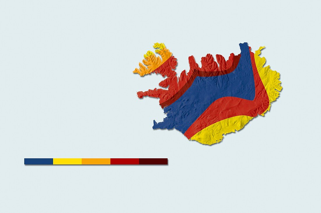
| Geothermal mapping,Iceland. Map of iceland,showing the temperature at a depth of two kilometres below the surface. This shows areas with a high potential for boreholes to be drilled to those depths,to extract geothermal power. The colour-coded key shows temperatures in degrees Celsius: less than 10 (blue),90-100 (yellow),100-120 (orange),120-150 (red) and 150-200 (brown) | |
| Lizenzart: | Lizenzpflichtig |
| Credit: | Science Photo Library / Lunau, Claus |
| Bildgröße: | 5138 px × 3420 px |
| Modell-Rechte: | nicht erforderlich |
| Eigentums-Rechte: | nicht erforderlich |
| Restrictions: | - |
Preise für dieses Bild ab 15 €
Universitäten & Organisationen
(Informationsmaterial Digital, Informationsmaterial Print, Lehrmaterial Digital etc.)
ab 15 €
Redaktionell
(Bücher, Bücher: Sach- und Fachliteratur, Digitale Medien (redaktionell) etc.)
ab 30 €
Werbung
(Anzeigen, Aussenwerbung, Digitale Medien, Fernsehwerbung, Karten, Werbemittel, Zeitschriften etc.)
ab 55 €
Handelsprodukte
(bedruckte Textilie, Kalender, Postkarte, Grußkarte, Verpackung etc.)
ab 75 €
Pauschalpreise
Rechtepakete für die unbeschränkte Bildnutzung in Print oder Online
ab 495 €
Keywords
- abgebildet,
- Atlantisch,
- ausgeschnitten,
- Ausschnitte,
- Energie,
- farbcodiert,
- geografisch,
- Geographie,
- Geologie,
- geologisch,
- geothermal,
- heiß,
- hellblauer Hintergrund,
- Hitze,
- Illustration,
- Insel,
- Island,
- Isländisch,
- Karte,
- Kunstwerk,
- Land,
- Leistung,
- Region,
- Schlüssel,
- Tief,
- Umweltwissenschaften,
- vulkanisch