Mapping the ocean floor,artwork
Bildnummer 11559034
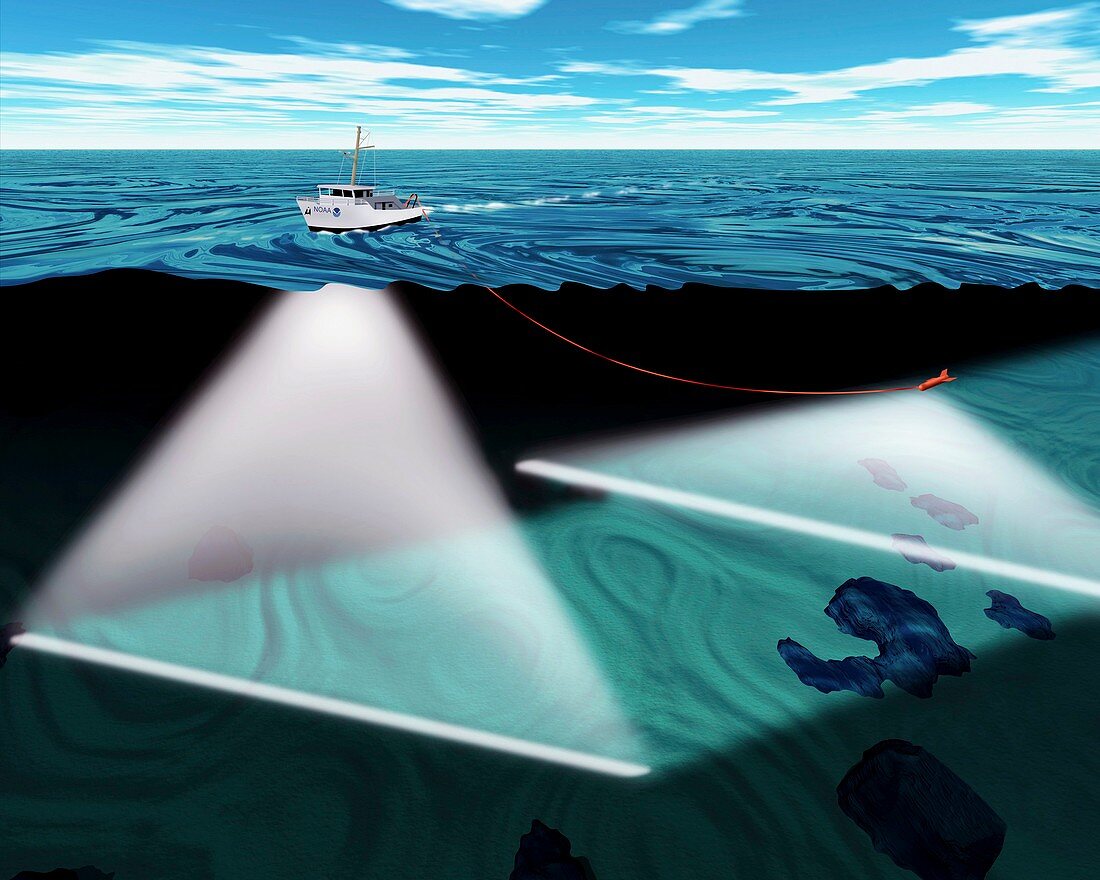
| Mapping the ocean floor. Computer artwork showing a ship using two sonar beams to map the ocean floor. The beam at the front of the picture is a hull-mounted multibeam sonar. The beam at the back is a sidescan sonar that is being towed on a cable (red). The sonar beams (sound waves) reflect off the ocean floor and are collected by a receiver. The time taken for the beam to return allows the depth of water to be calculated. Maps of the ocean floor can be used to study plate tectonics,model ocean currents,and map wildlife habitats,amongst other applications | |
| Lizenzart: | Lizenzpflichtig |
| Credit: | Science Photo Library / NOAA |
| Bildgröße: | 4700 px × 3760 px |
| Modell-Rechte: | nicht erforderlich |
| Eigentums-Rechte: | nicht erforderlich |
| Restrictions: |
|
Preise für dieses Bild ab 15 €
Universitäten & Organisationen
(Informationsmaterial Digital, Informationsmaterial Print, Lehrmaterial Digital etc.)
ab 15 €
Redaktionell
(Bücher, Bücher: Sach- und Fachliteratur, Digitale Medien (redaktionell) etc.)
ab 30 €
Werbung
(Anzeigen, Aussenwerbung, Digitale Medien, Fernsehwerbung, Karten, Werbemittel, Zeitschriften etc.)
ab 55 €
Handelsprodukte
(bedruckte Textilie, Kalender, Postkarte, Grußkarte, Verpackung etc.)
ab 75 €
Pauschalpreise
Rechtepakete für die unbeschränkte Bildnutzung in Print oder Online
ab 495 €