The Arctic,topographic map
Bildnummer 11555497
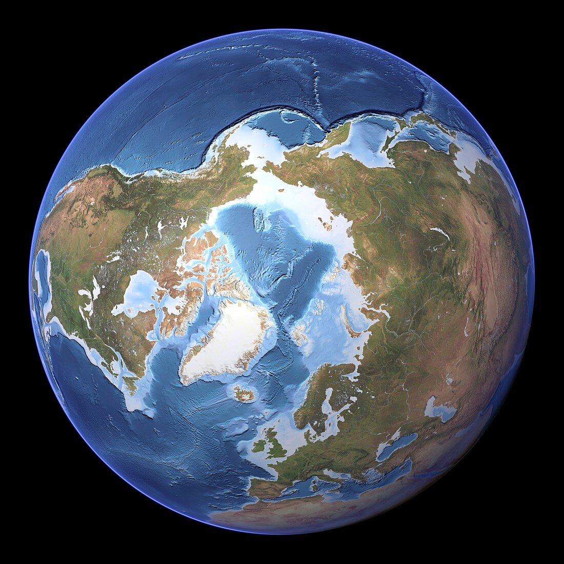
| The Arctic,topographic map. This map is centred on the North Pole,with Greenland (white) at centre left,North America at left,and Eurasia at right. The seabed depth varies from shallow (light blue) on the continental shelves,to deep ocean basins (dark blue). The Pacific Ocean (top) contains the deepest point in the world's oceans. Highlands and lowlands of the continents are shown as ridges and flat areas. Topographic and bathymetric data is usually gathered by using aerial and satellite imagery combined with radar and sonar mapping | |
| Lizenzart: | Lizenzpflichtig |
| Credit: | Science Photo Library / Planetary Visions |
| Bildgröße: | 4193 px × 4193 px |
| Modell-Rechte: | nicht erforderlich |
| Eigentums-Rechte: | nicht erforderlich |
| Restrictions: | - |
Preise für dieses Bild ab 15 €
Universitäten & Organisationen
(Informationsmaterial Digital, Informationsmaterial Print, Lehrmaterial Digital etc.)
ab 15 €
Redaktionell
(Bücher, Bücher: Sach- und Fachliteratur, Digitale Medien (redaktionell) etc.)
ab 30 €
Werbung
(Anzeigen, Aussenwerbung, Digitale Medien, Fernsehwerbung, Karten, Werbemittel, Zeitschriften etc.)
ab 55 €
Handelsprodukte
(bedruckte Textilie, Kalender, Postkarte, Grußkarte, Verpackung etc.)
ab 75 €
Pauschalpreise
Rechtepakete für die unbeschränkte Bildnutzung in Print oder Online
ab 495 €
Keywords
- abgebildet,
- Altimetrie,
- altimetrisch,
- Arktis,
- Arktischer Ozean,
- Asien,
- Atlantischer Ozean,
- ausgeschnitten,
- Ausschnitte,
- Bathymetrie,
- bathymetrisch,
- Becken,
- Berge,
- Daten,
- Erde,
- Eurasien,
- Europa,
- geografisch,
- Geographie,
- Globus,
- Grat,
- Karte,
- kombinierte Daten,
- Kontinent,
- Kontinente,
- Kreis,
- kreisförmig,
- Kugel,
- kugelförmig,
- Land,
- Marine,
- Meer,
- Meeresboden,
- Meereskunde,
- Modell-,
- Nordamerika,
- nördliche Hemisphäre,
- Nordpol,
- Ozean,
- ozeanisch,
- Pazifik,
- Planet,
- polar,
- Regale,
- Region,
- rund,
- Russland,
- Satellit,
- Satellitenbild,
- Sibirien,
- Tiefe,
- topografisch,
- Topographie,
- Welt