Hurricane Vince,October 2005
Bildnummer 11551022
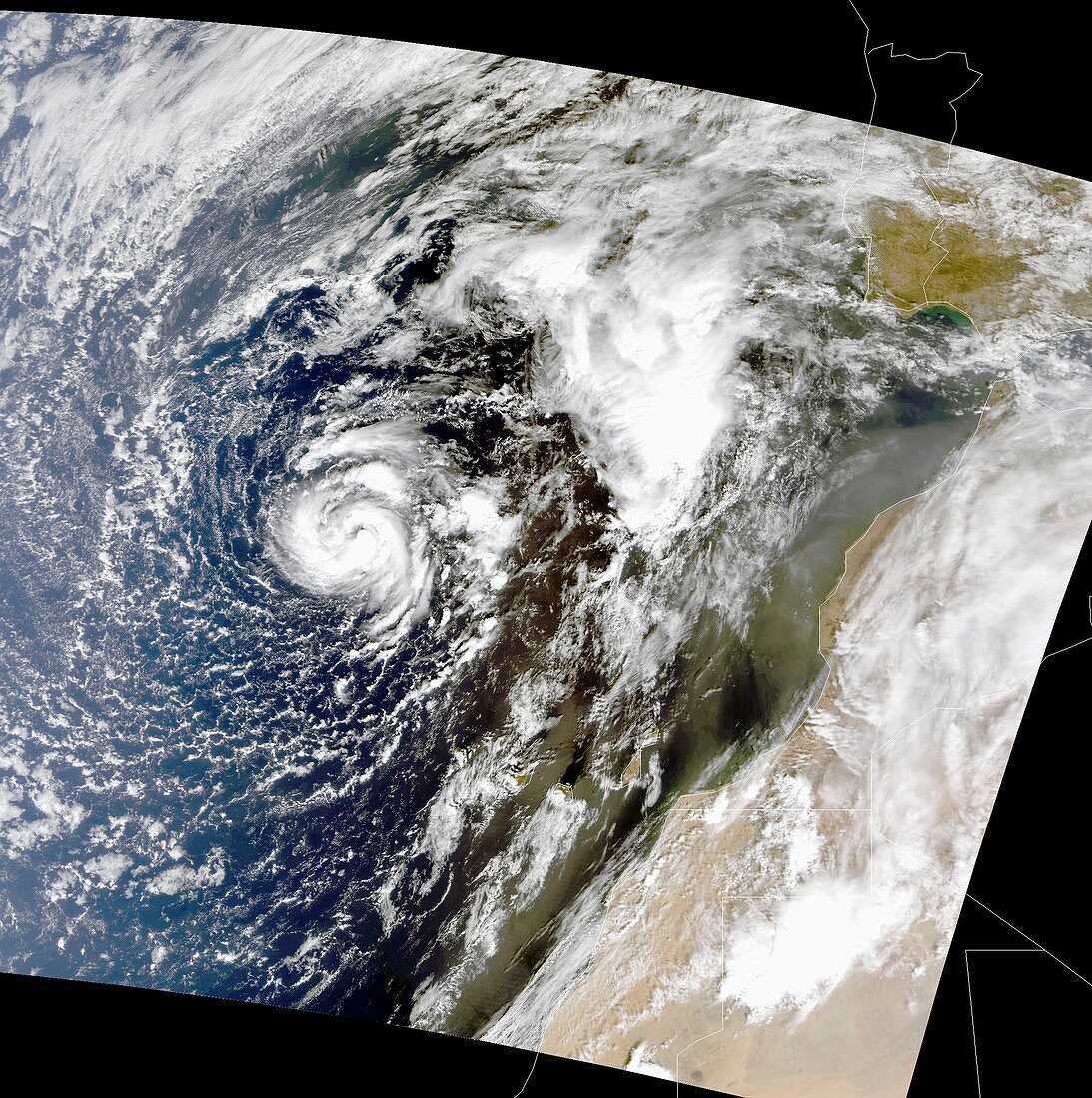
| Hurricane Vince. Satellite image showing Vince developing from a non-tropical system,to become a subtropical storm southeast of the Azores in the Atlantic Ocean. Vince later developed into a category 1 hurricane with a bona fide eye 25 kilometres in diameter and wind speeds of 120 kilometres per hour (km/h). The storm weakened at sea and,on 11th October,made landfall on the Iberian Peninsula as a tropical depression. Image obtained on 8th October 2005 from NASA's Terra satellite | |
| Lizenzart: | Lizenzpflichtig |
| Credit: | Science Photo Library / NASA |
| Bildgröße: | 3250 px × 3270 px |
| Modell-Rechte: | nicht erforderlich |
| Eigentums-Rechte: | nicht erforderlich |
| Restrictions: | - |
Preise für dieses Bild ab 15 €
Universitäten & Organisationen
(Informationsmaterial Digital, Informationsmaterial Print, Lehrmaterial Digital etc.)
ab 15 €
Redaktionell
(Bücher, Bücher: Sach- und Fachliteratur, Digitale Medien (redaktionell) etc.)
ab 30 €
Werbung
(Anzeigen, Aussenwerbung, Digitale Medien, Fernsehwerbung, Karten, Werbemittel, Zeitschriften etc.)
ab 55 €
Handelsprodukte
(bedruckte Textilie, Kalender, Postkarte, Grußkarte, Verpackung etc.)
ab 75 €
Pauschalpreise
Rechtepakete für die unbeschränkte Bildnutzung in Print oder Online
ab 495 €