Magellan mosaic of Venus east hemisphere with grid
Bildnummer 11881732
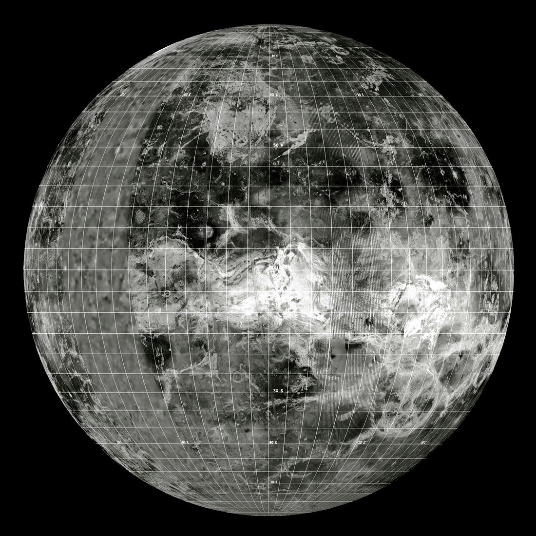
| Radar map of the east hemisphere of Venus,with latitude and longitude grid superimposed. The image is centered on the equator at 90 degrees east longitude,with the north pole at the top. The dominant radar-bright feature at centre is the continent Aphrodite Terra. The vast,circular Artemi Chasma canyon is at bottom right. The radar-bright feature in the northern hemisphere is the upland Tellus Regio,separated from Aphrodite Terra by the dark,lowland Niobe Planitia. The data for this image were gathered by the Magellan radar-mapping spacecraft. Areas of missing Magellan data have been filled in with lower- resolution Pioneer-Venus data | |
| Lizenzart: | Lizenzpflichtig |
| Credit: | Science Photo Library / NASA |
| Bildgröße: | 4201 px × 4201 px |
| Modell-Rechte: | nicht erforderlich |
| Eigentums-Rechte: | nicht erforderlich |
| Restrictions: | - |
Preise für dieses Bild ab 15 €
Universitäten & Organisationen
(Informationsmaterial Digital, Informationsmaterial Print, Lehrmaterial Digital etc.)
ab 15 €
Redaktionell
(Bücher, Bücher: Sach- und Fachliteratur, Digitale Medien (redaktionell) etc.)
ab 30 €
Werbung
(Anzeigen, Aussenwerbung, Digitale Medien, Fernsehwerbung, Karten, Werbemittel, Zeitschriften etc.)
ab 55 €
Handelsprodukte
(bedruckte Textilie, Kalender, Postkarte, Grußkarte, Verpackung etc.)
ab 75 €
Pauschalpreise
Rechtepakete für die unbeschränkte Bildnutzung in Print oder Online
ab 495 €