Bouvet Island,Landsat 8 image
Bildnummer 11690155
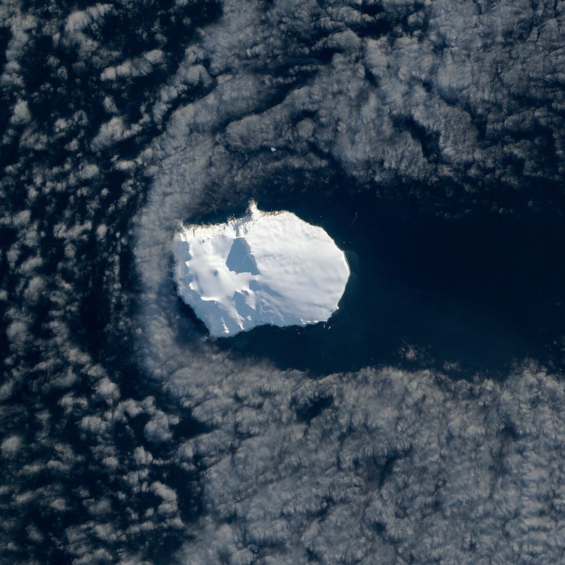
| Bouvet Island. Satellite image of clouds and sea surrounding the remote and ice-covered volcanic island of Bouvet in the South Atlantic. North is at top. This uninhabited island,a dependency of Norway,has an area of 49 square kilometres. The southernmost extension of the Mid-Atlantic Ridge,it is a shield volcano with a prominent caldera (left,Wilhelmplataet) and steep ice cliffs. The nearest land is Antarctica 17000 kilometres to the south. The nearest inhabited land is 2260 kilometres to the north-west. Image data obtained on 26 May 2013 by the Operational Land Imager (OLI) on the Landsat 8 satellite | |
| Lizenzart: | Lizenzpflichtig |
| Credit: | Science Photo Library / NASA Earth Observatory |
| Bildgröße: | 2965 px × 2965 px |
| Modell-Rechte: | nicht erforderlich |
| Eigentums-Rechte: | nicht erforderlich |
| Restrictions: | - |
Preise für dieses Bild ab 15 €
Universitäten & Organisationen
(Informationsmaterial Digital, Informationsmaterial Print, Lehrmaterial Digital etc.)
ab 15 €
Redaktionell
(Bücher, Bücher: Sach- und Fachliteratur, Digitale Medien (redaktionell) etc.)
ab 30 €
Werbung
(Anzeigen, Aussenwerbung, Digitale Medien, Fernsehwerbung, Karten, Werbemittel, Zeitschriften etc.)
ab 55 €
Handelsprodukte
(bedruckte Textilie, Kalender, Postkarte, Grußkarte, Verpackung etc.)
ab 75 €
Pauschalpreise
Rechtepakete für die unbeschränkte Bildnutzung in Print oder Online
ab 495 €
Keywords
- 1,
- 2013,
- 21. Jahrhundert,
- Abhängigkeit,
- Atlantisch,
- Caldera,
- einer,
- Eis,
- eisbedeckt,
- eisig,
- Erdbeobachtung,
- fern,
- Gefroren,
- geografisch,
- Geographie,
- Geologie,
- geologisch,
- Glaziologie,
- Insel,
- isoliert,
- Kalt,
- Landsat 8,
- Meer,
- Niemand,
- Norwegisch,
- oli,
- Ozean,
- Satellit,
- Satellitenbild,
- Single,
- Südatlantik,
- Unbewohnt,
- Vulkan,
- vulkanisch,
- Vulkanologie,
- Weltall