Lakes George and Edward,Uganda
Bildnummer 11688712
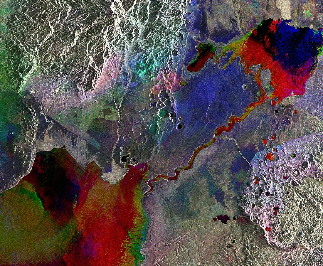
| Composite radar satellite image of a section of the Albertine Rift in Uganda. At top right is Lake George,which is connected to Lake Edward (bottom left) by the Kazinga channel. The different colours in the lakes and channel show the differing water levels on the three dates between June 2007 and July 2008 that the images were taken. The area at top left is mainly agricultural land. Here the differing colours show changes in vegetation. Image obtained by the Envisat satellite | |
| Lizenzart: | Lizenzpflichtig |
| Credit: | Science Photo Library / ESA |
| Bildgröße: | 5699 px × 4692 px |
| Modell-Rechte: | nicht erforderlich |
| Eigentums-Rechte: | nicht erforderlich |
| Restrictions: |
|
Preise für dieses Bild ab 15 €
Universitäten & Organisationen
(Informationsmaterial Digital, Informationsmaterial Print, Lehrmaterial Digital etc.)
ab 15 €
Redaktionell
(Bücher, Bücher: Sach- und Fachliteratur, Digitale Medien (redaktionell) etc.)
ab 30 €
Werbung
(Anzeigen, Aussenwerbung, Digitale Medien, Fernsehwerbung, Karten, Werbemittel, Zeitschriften etc.)
ab 55 €
Handelsprodukte
(bedruckte Textilie, Kalender, Postkarte, Grußkarte, Verpackung etc.)
ab 75 €
Pauschalpreise
Rechtepakete für die unbeschränkte Bildnutzung in Print oder Online
ab 495 €