Dust storm over the Aral sea
Bildnummer 11679137
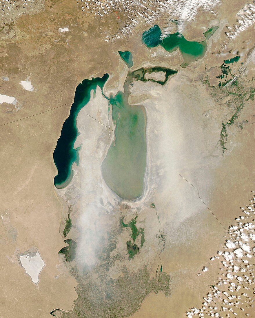
| Satellite image of a dust storm over the Aral sea. The Aral sea lies between Kazakhstan in the north and Uzbekistan in the south. Once one of the largest lakes on Earth,it has been steadily shrinking since the 1960s,after the rivers that fed it were diverted by Soviet irrigation projects. Image taken 13 June 2006,by NASA's MODIS (moderate resolution imaging spectroradiometer) aboard the Aqua (EOS PM) satellite | |
| Lizenzart: | Lizenzpflichtig |
| Credit: | Science Photo Library / Jeff Schmaltz / NASA |
| Bildgröße: | 2649 px × 3311 px |
| Modell-Rechte: | nicht erforderlich |
| Eigentums-Rechte: | nicht erforderlich |
| Restrictions: | - |
Preise für dieses Bild ab 15 €
Universitäten & Organisationen
(Informationsmaterial Digital, Informationsmaterial Print, Lehrmaterial Digital etc.)
ab 15 €
Redaktionell
(Bücher, Bücher: Sach- und Fachliteratur, Digitale Medien (redaktionell) etc.)
ab 30 €
Werbung
(Anzeigen, Aussenwerbung, Digitale Medien, Fernsehwerbung, Karten, Werbemittel, Zeitschriften etc.)
ab 55 €
Handelsprodukte
(bedruckte Textilie, Kalender, Postkarte, Grußkarte, Verpackung etc.)
ab 75 €
Pauschalpreise
Rechtepakete für die unbeschränkte Bildnutzung in Print oder Online
ab 495 €